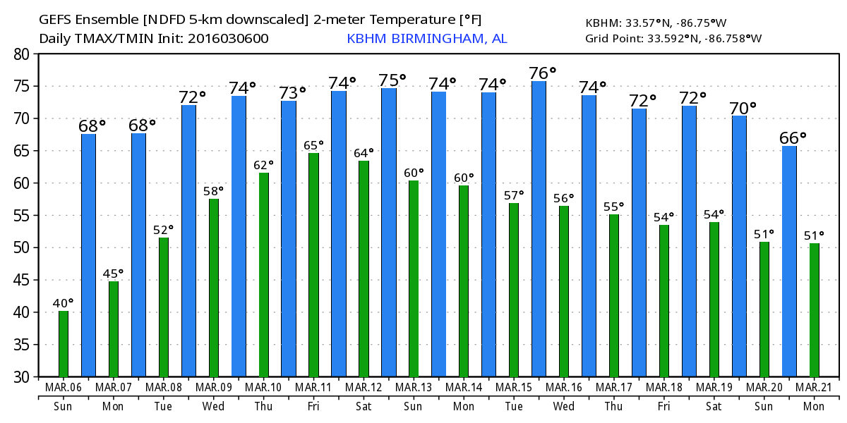
The Alabama sky was almost completely clear this morning with only a few streaks of high clouds visible in isolated spots across the southern portion of the state. Temperatures this morning were again a bit nippy, but most locations were slightly above the low temperatures of Saturday morning. While most spots were in the 30s in North and Central Alabama, a few places in the northeast quadrant did once again see the temperature reach the freezing mark. Temperatures are expected to rebound fairly quickly today with highs again reaching the middle 60s. So another rather nice day to get outside and enjoy the weather.
An upper level ridge will pump up strongly across the eastern third of the US during the first half of the week as a very deep trough develops to our west with a closed upper low digging into northern Mexico. This will keep us dry through Wednesday as temperatures gradually climb each day in response to the warming of a southerly flow pattern. Highs will reach near 70 on Monday and into the middle 70s by Wednesday.
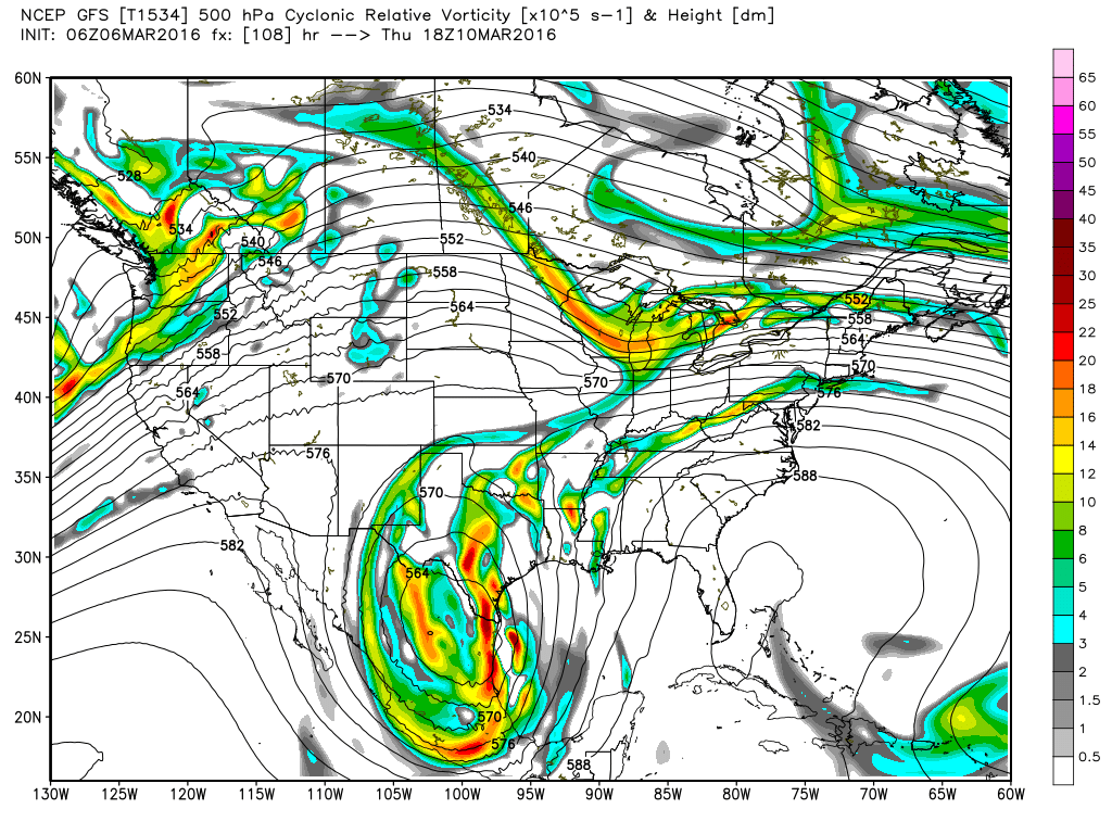
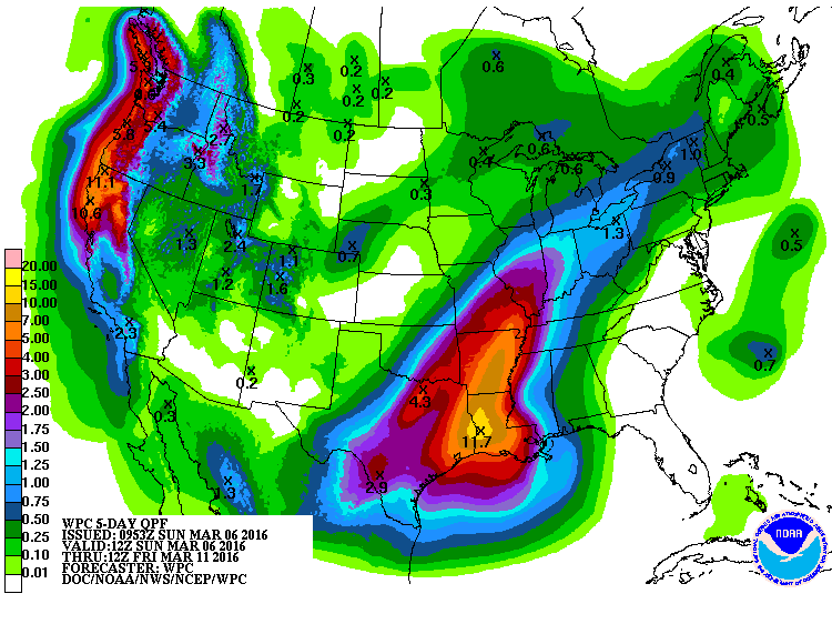
And this is where the real challenge comes in and also where the models begin to show some differences. Thursday that closed low over northern Mexico begins to eject to the north, however, it is going to do so slowly. And as it does, small perturbations will rotate out of the base of the closed low and bring rain chances to Alabama. This pattern will tap into a great deal of moisture including some from the Pacific and the western Gulf. This together with the relatively slow motion of the closed low will set up a significant rain event for portions of the Lower Mississippi River Valley especially Arkansas, Louisiana, and the eastern portion of Texas. The QPF guidance suggestions rainfall through Friday morning for this area could reach between 5 and 11 inches.
The GFS and Euro are in fairly good agreement on the broad features, however, they are pretty far from each other when you look at the details. It does seem that the Euro is way slower than the GFS, so I’m sticking the GFS solution for now which in itself is not speedy. The change from the model run of the GFS 24 hours ago is minimal, so we’re beginning to see some consistency from run-to-run. So using the GFS solution, our rain chances begin to pick up on Thursday with small chances and ramp up to widespread rain by Saturday.
Saturday is a long way out, so timing of the various short waves rotating out of that deep closed low is nearly impossible to nail down this far out. It does look like we might see the risk for strong storms on Saturday as forecast CAPE values will ramp up into the range of 1200 to 1600 j/kg over Alabama. Definitely a stay tuned situation.
The upper closed low weakens and moves to the East Coast Sunday, but the GFS is positioning yet another closed low over Northwest Oklahoma, so there won’t be much of a break between weather systems.
Looking out into voodoo country, the GFS puts the Southeast US under another ridge around March 15th. The ridge will be strong, so the next system coming out of the Rockies on the 16th is not likely to impact us until around the 19th. The forecast period ends with another ridge as yet another trough digs into the Southwest US.
Our storm spotter training commences on Tuesday as we open at the community center in Jacksonville, AL. The program begins at 6:30 pm. James Spann will be back in the saddle Monday morning with the next edition of the Weather Xtreme Video. Have a nice day and Godspeed.
-Brian-