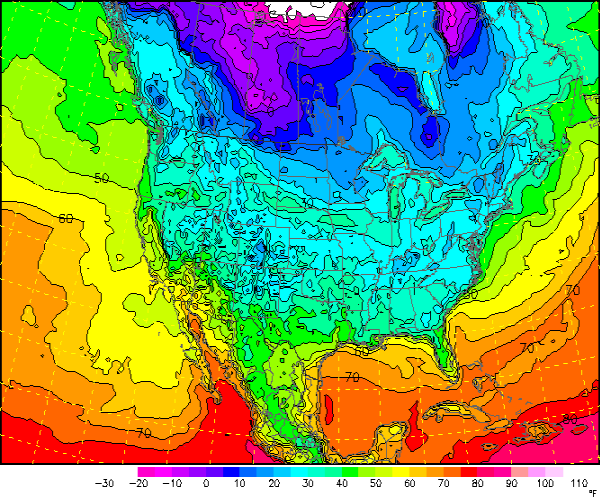
After yesterday’s cold front passed through much colder air is settling in behind the front. The strong north winds today will continue to bring the colder air into Central Alabama and the Southeast. The winds are expected to go calm this evening, and with no cloud cover, optimal radiational cooling will take affect. Temperature will drop like a rock as we head through the overnight hours and by tomorrow morning, many areas will have a hard freeze as the average low will be around 27. Some areas will be in the lower 20s. This is the coldest weather we have experienced this season. Freeze warnings extend all the way down to the Gulf Coast and into the Peninsula of Florida. The forecast map below shows many areas will be in upper 20s overnight.
Published on: November 24, 2012 at 6:01 PM
Related Articles
October 31, 2026 at 7:11 AM
Scattered Showers for Halloween
Our dry, benign weather pattern gives way to a more active pattern starting today. An upper-level shortwave moves through Alabama today and tomorrow bringing some rain to the state this weekend. The beginning of next week will be on the drier and quieter side before an upper-level trough pushes a surface low-pressure system through Alabama on Wednesday, bringing more rain and some storms. The week will end dry. Continue reading →
READ MORE
October 30, 2026 at 3:02 PM
Some Rain At Times Over The Weekend
WARM AFTERNOON: Temperatures are between 77 and 82 degrees across Alabama this afternoon with sun through high cirrus clouds. No rain on radar. Clouds will increase tonight. We will mention a chance of showers statewide over the weekend. A few … Continue reading →
READ MORE