


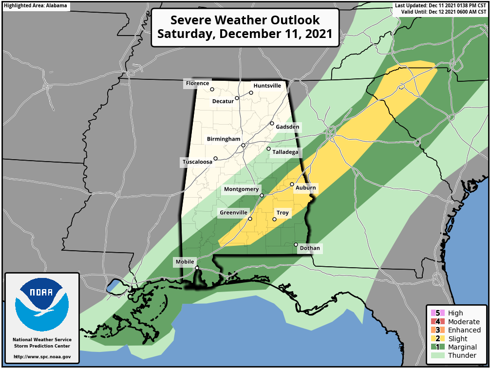
The Storm Prediction Center has reduced the severe weather threat to locations roughly south and east of a line from Minter (Dallas Co.) to Prattville (Autauga Co.) to Roanoke (Randolph Co.). Within that define area, there is a Slight Risk up for locations along and south of the I-85 corridor, with a Marginal Risk immediately surrounding it.
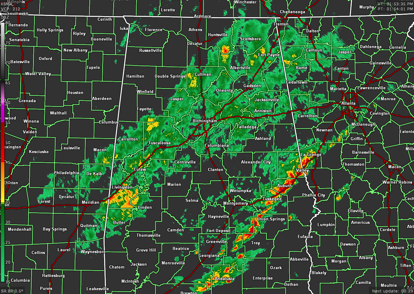
The main squall line of storms has made it to the I-85 corridor and is continuing to push eastward out of the area. While there are some breezy conditions within some of the cells along the line, none of these cells are overly impressive. However, the strongest storms will be affecting Pike and Bullock counties from now through 2:45 pm. The risk of any stronger to severe storms will continue along and ahead of the line until it pushes out of the area, which should be around 6 pm or earlier.
A secondary band of light to moderate rain is falling over the northeast to the central to the southwestern locations of North Alabama, mainly lined up along and around the I-59 corridor. This activity will continue to slowly follow the main line of storms through and out of the area by later tonight.



