


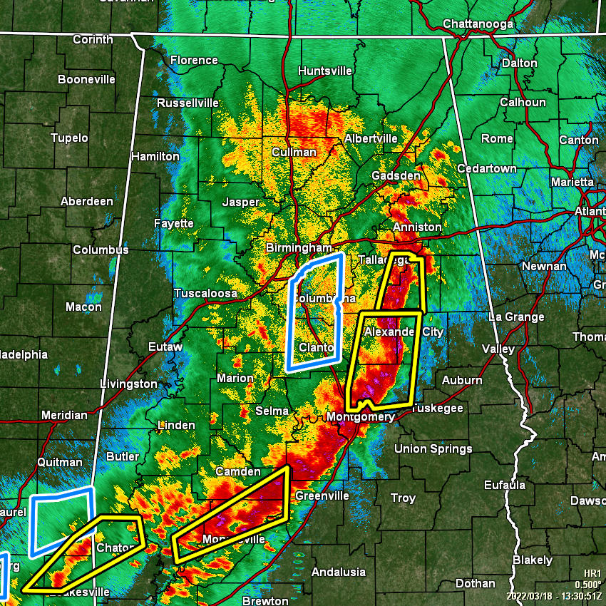
As of 8:30 am this morning, a line of strong to severe storms continue to push eastward across the eastern half of Central Alabama, now stretching from Gadsden and Anniston, back to the south and southwest through Alexander City and Montgomery and approaching Fort Deposit in the extreme southern portion of the area.
The severe threat has ended for this first round of storms for locations along and west of a line from Gadsden to Clanton to Selma. The treat will continue along and ahead of the line of storms through the rest of the morning hours. However, this is only the first round of storms for the day. The second round will come in a more scattered fashion during the afternoon and evening hours.
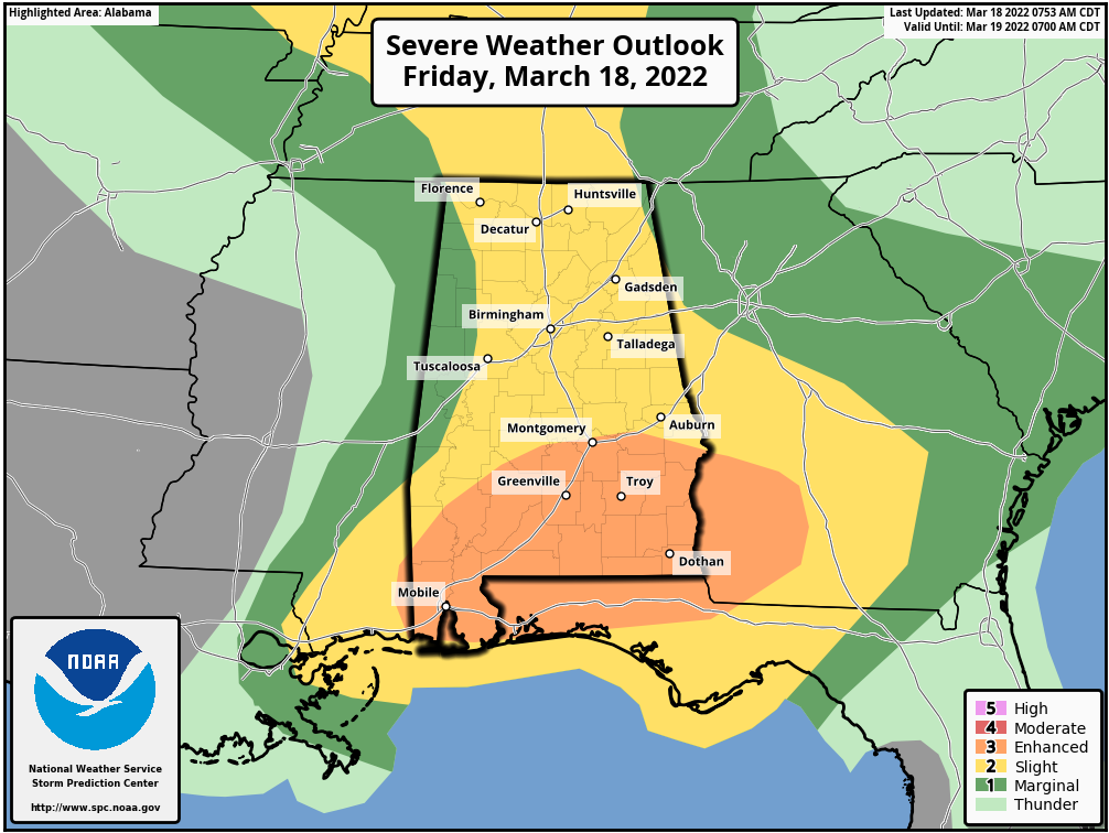
An ENHANCED RISK is up for locations along and south of a line from just south of the Selma Airport to Montgomery to just south of Fort Mitchell in Russell County. A SLIGHT RISK encases much of the rest of North/Central Alabama except for locations west of a line from Waterloo (Lauderdale Co.) to Brilliant (Marion Co.) to Eutaw (Greene Co.) in the western parts of the area, and east of a line from Bridgeport (Jackson Co.) to New Moon (Cherokee Co.) in the extreme northeastern corner of the area. Those locations are in a MARGINAL RISK.
We’ll have to see if we can dry out enough after this first round of rain and storms move out of the area to see if we can get the atmosphere to re-destabilize with the main heating of the day. If sunshine breaks out, chances will be a little higher that it will become more unstable and scattered to numerous thunderstorms will develop, potentially leading to more strong to severe storms. Damaging winds, tornadoes, and quarter size hail will be possible with any severe storm this afternoon and evening.
Stay weather aware and be prepared throughout the day. We’ll have updates.



