


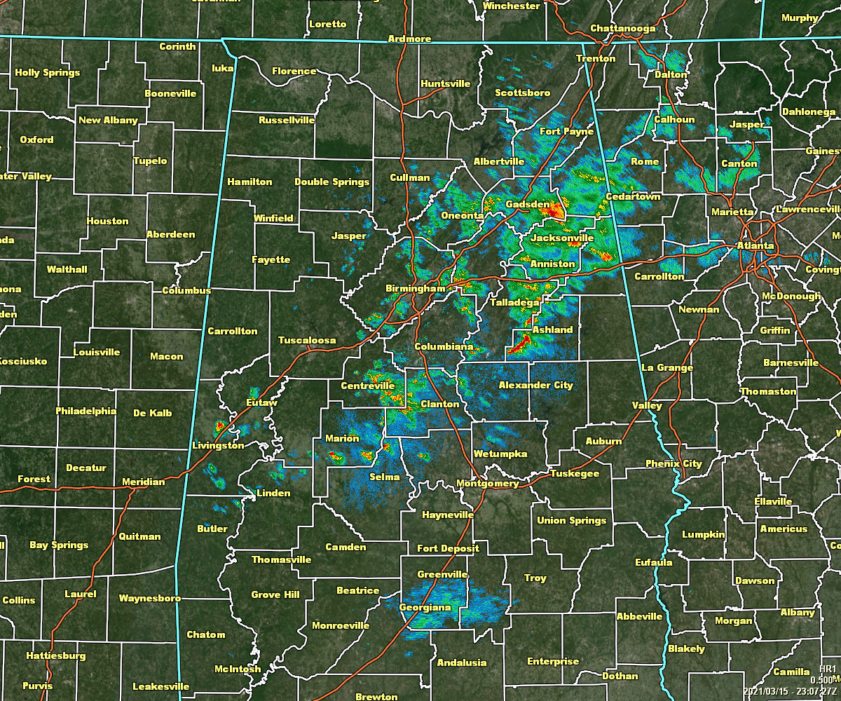
Radar shows a broken line of rain and thunderstorms stretching across North/Central Alabama from Fort Payne and Gadsden southwestward toward Leeds and Moody with the activity becoming more widely scattered down towards Centreville and Marion. None of this activity is strong or severe at the moment, but the risk of isolated damaging wind gusts up to 60 mph, hail up to quarter-size, and a brief spin-up tornado continues to be in place.
Here is what we are looking at as of 6:10 pm:
• Instability values are the greatest away from much of the activity, with values ranging from 1000-2000 J/kg.
• We also have a decent amount of shear in place with values ranging from 50-70 knots across the area from southwest to northeast. These numbers are more than sufficient for supporting organized storms and the potential for supercells.
• Helicity values for much of the area are less than desired for severe storms for the western half of the area and for much of the southern half. The higher helicity values are displaced from the instability, but are not that far away over the northwestern quarter of the area.
If the instability can work over into the northwestern quarter of North/Central Alabama before the better helicity moves out of the area, we might see a few stronger to potentially stronger storms north of I-20 and east of I-65. For now, all shower activity is staying well-behaved and has weakened over the past couple of hours. We’ll also have to watch for any redevelopment along the front back in the western parts of the area.
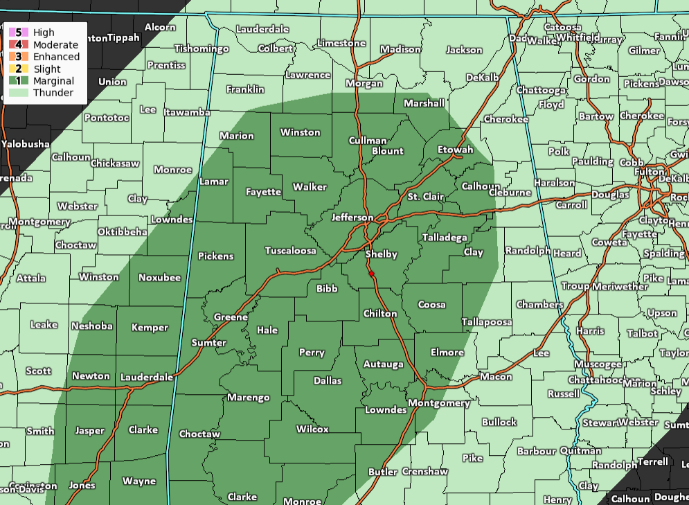
SPC continues a Level 1 Marginal Risk for the rest of tonight and through the pre-dawn hours on Tuesday for much of Central Alabama and the extreme south-central parts of North Alabama, while the main window for stronger to severe storms is expected to close around 10 pm tonight.



