


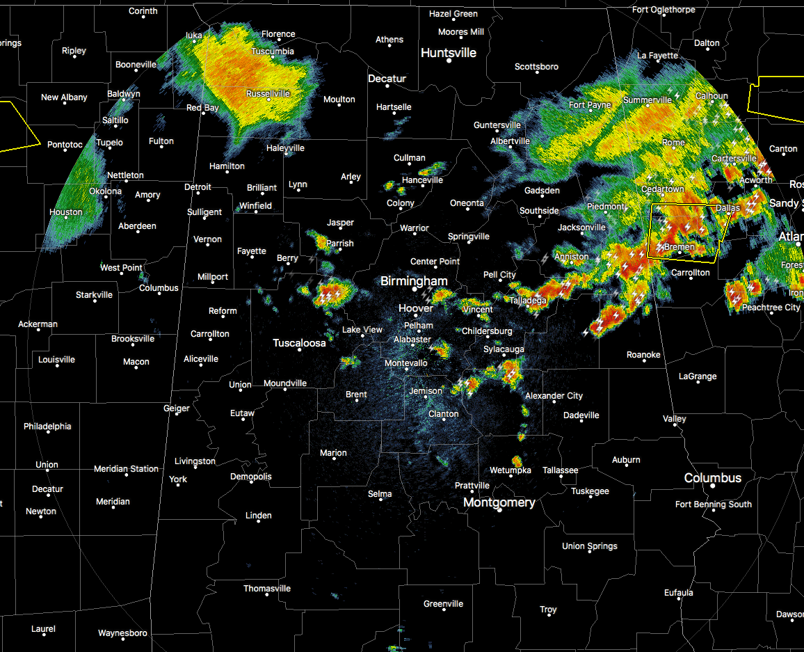
Strong thunderstorms continue to move east-southeastward through the northern half of Alabama with multiple significant weather advisories issued on several of these in the eastern parts of the area. There was a Severe Thunderstorm Warning issued for the cell in northern Tuscaloosa county for the possibility of thunderstorm wind gusts up to 60 MPH and quarter size hail. It has since expired, but that storm is still putting down heavy rainfall and dangerous cloud-to-ground lightning.
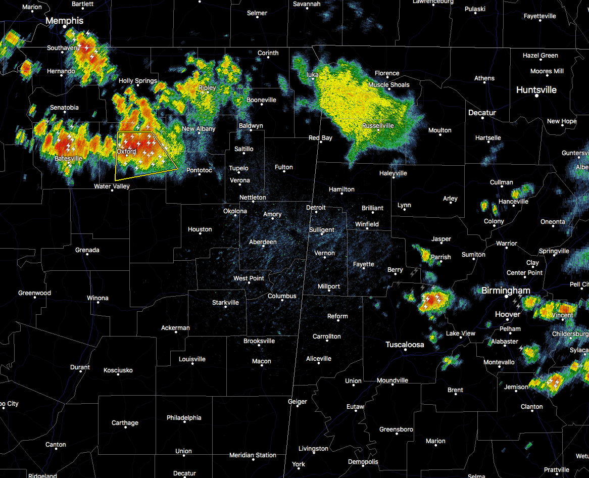
More storms are expected to develop across the area along a boundary that will be left behind from the storms that are continuing to move into Georgia. Along with development in the area, there is another batch of strong to severe thunderstorms that will move into the western parts of the area later today. These should keep their strength as they will eventually make their way into Central Alabama. Latest HRRR model run shows this batch of storms making it into Birmingham by 6:00 PM.
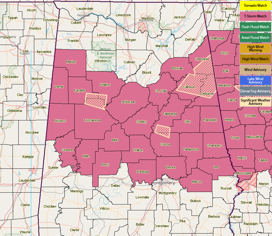
A Severe Thunderstorm Watch continues until 9:00 PM tonight for much of the area.
We’ll keep you posted throughout the afternoon and into the evening.



