


At 1:58 pm, we have showers and thunderstorms moving across the northeastern and northwestern parts of North/Central Alabama with no development over the southern half of the area south of the I-59 corridor. There is shower activity over the AL/GA state line, but all of that will be out of the state shortly.
The strongest storms are starting to make their way out of the northeastern parts of North Alabama, but may take another hour or so as they are creeping along at 25 MPH. Some gusty winds and small hail are possible with these, but they should stay below severe limits.
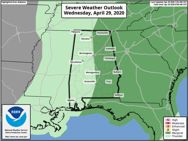
The Storm Prediction Center continues a Marginal Risk for locations along and east of the I-65 corridor throughout the area, mainly from Thach (Limestone Co.) to Mountain Brook (Jefferson Co.) to Fort Deposit (Lowndes Co.). We are in the main window for the potential of strong to severe storms and that should close by 7:00 pm tonight.
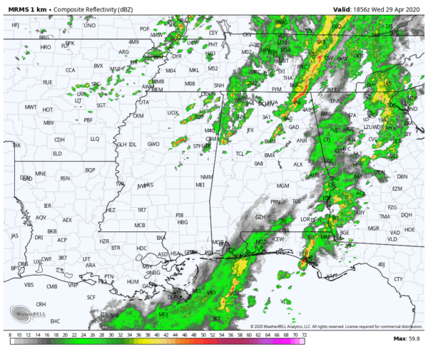
We still have some shower activity back into Mississippi that we’ll have to watch as it moves into the central parts of the area later this afternoon as we still have the potential for damaging winds up to 60 MPH. The good news is that there are no severe weather warnings in effect for anyone in Alabama or in the southeastern parts of the US.



