


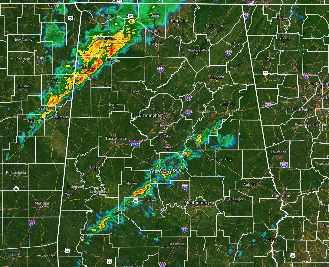
The main line of storms stretch from roughly Athens and Decatur down to the southwest through Russellville and Haleyville, and exits back into Mississippi through the northern parts of Lamar County. So far, the line is staying well-behaved, but some brief gusty winds can be expected in the stronger parts of the line.
There is a weaker line of showers that has formed over the south-central pars of the area stretching from Sweet Water (Marengo Co.) to Talladega. All of the activity is moving eastward around 30-35 mph.
For now, conditions are not very supportive for severe storms, but with the heating of the day, instability values will rise and storms most likely will grow stronger. If we have any sunshine for a little while ahead of the line, that will only make the instability higher.
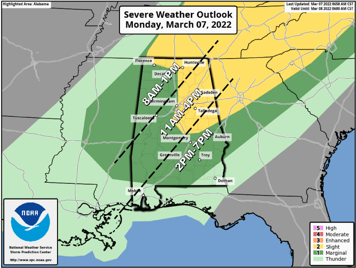
The Storm Prediction Center continues a Slight Risk for locations along and east of a line from just north of Florence to the Huntsville International Airport to Birmingham to just west of Clanton to LaFayette. The rest of North and Central Alabama are in a Marginal Risk for severe storms.
The main threats will be from damaging winds up to 60 mph and hail up to 1 inch in diameter, with a very small threat of a brief spin-up tornado, especially in the slight risk area. The wind and hail threats will be more isolated in the marginal risk area.
The main window for the threat of severe storms is still the same for the area… From now to 1 pm for the north and northwestern parts, from 11 am to 4 pm for the northeast, central, and southwestern parts of the area, and from 2 pm to 7 pm for the south and southeastern parts.



