


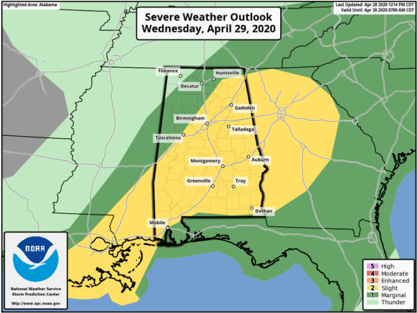
A LEVEL 2 SLIGHT RISK is up for locations along and south of a line from Livingston (Sumter Co.) to Gorgas (Walker Co.) to Paint Rock (Jackson Co.) to Ider (Dekalb Co.).
A LEVEL 1 MARGINAL RISK is up north of that to a line from Bexar (Marion Co.) to Lester (Limestone Co.).
The main threat will be from damaging straight-line thunderstorm wind gusts up to 60 MPH. There will be a smaller threat of some hail and an even smaller threat of a brief tornado or two, but it is not likely that we’ll see a tornado.
The main threat window for stronger to severe storms continues to be from Wednesday morning at 6:00 am to as late as 6:00 pm Wednesday evening.
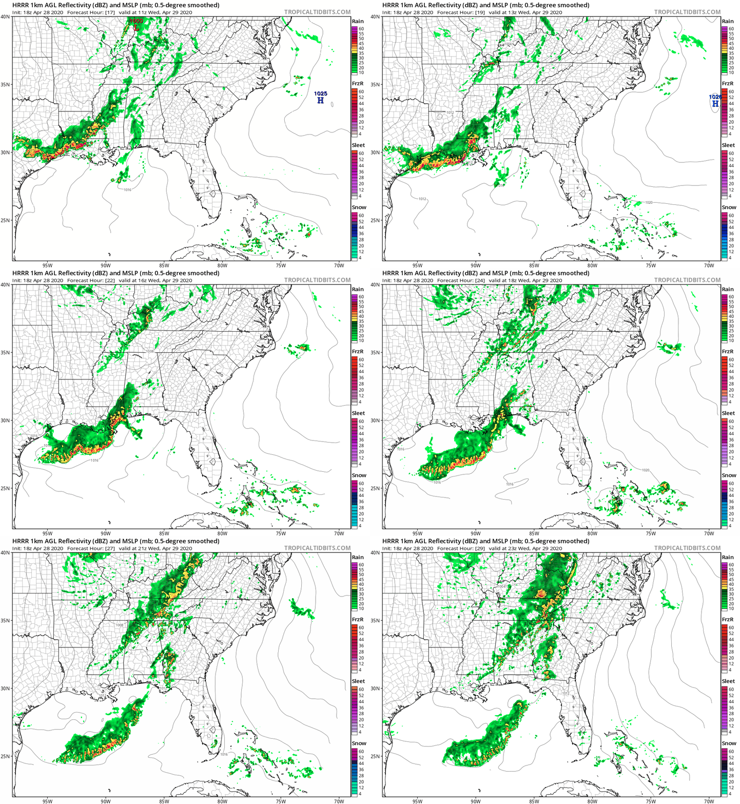
The above animation (valid Wednesday from 6:00 am to 6:00 pm) is from the 18z run of the HRRR which continues to show the potential of two waves of storms moving through the area on Wednesday. The first wave will begin to move into the area as a weakening line of showers and storms which looks to fall apart into a few scattered showers by 9:00 am. By the time we get to the noon hour, we see that another line of showers and storms are starting to form back off to our north and northwest. These will be pushing southeastward through the area during the rest of the afternoon and into the evening. Along with that, storms will begin refiring along a boundary that was left over from the first line that died out during the morning. The second wave of storms will be over the I-59 corridor around 5:00 pm and will continue to push southeast until eventually weakening and moving out of the area by 10:00 pm.
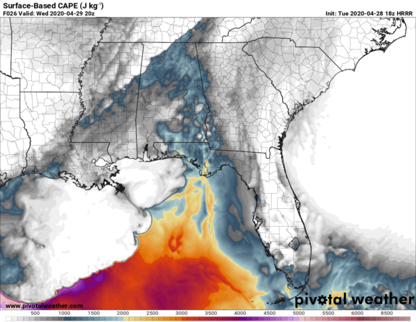
The HRRR (valid at 3:00 pm) also shows a decent amount of instability moving up into the southeastern parts of the area along with the second wave of storms bringing its on instability with it. Values are topping out close to 2000 J/kg. Values of 500-1500 J/kg are considered moderately unstable, 1501-2500 J/kg is strongly unstable, and anything greater than 2500 J/kg is considered extremely unstable.
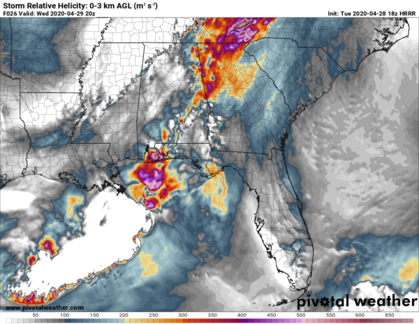
At the same time, helicity values will be higher over the east and southeastern parts of the area, reaching as high as 500 m2/s2. Values above 250 m2/s2 suggest the potential of rotating updrafts could lead to an increased threat of tornadoes.
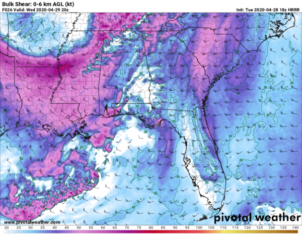
Our saving grace from having a larger severe weather threat in the east and southeastern parts of the area is that there will be weaker shear out ahead of the second wave of storms. Shear values would need to be 35-40 knots and greater to be supporting for supercells, and this is only showing shear values 15-40 knots ahead of the second line of storms. The higher shear values are along and behind the second line of storms which will be occurring in more stable air. Unfortunately along the line, shear values are topping out at 70 knots.
This all comes together and shows that the main threat will be from damaging straight-line wind gusts up to 60 MPH. Some hail may be possible as well, but possibly not up to severe limits. A brief tornado may be possible south of the I-59 corridor during the afternoon hours, but the threat is really low at this point. This is, however, the main severe weather season for Central Alabama… so expect the unexpected.
We’ll have updates throughout the day on Wednesday, along with watches and warnings as soon as they are issued. Have a great evening.



