


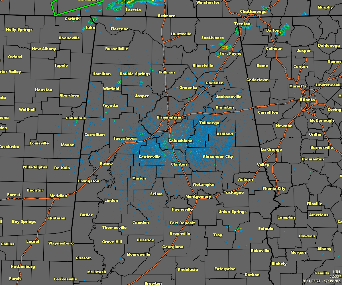
As of 12:40 pm, a few isolated showers have formed across the area, most of which are north of the I-59 corridor over the northern half of the area. There is also a few showers that have popped up over the extreme southeastern portions of the area, especially around and just west of Clayton in Barbour County.
No severe weather watches or warnings are currently in effect for North/Central Alabama, but a Flash Flood Watch continues until 7:00 pm Sunday evening for Colbert, Franklin, Jackson, Lauderdale, Lawrence, Limestone, Madison, and Morgan counties in North Alabama.
Temperatures as of the 12 pm roundup were in the lower 70s to the lower 80s across North Alabama, with Muscle Shoals leading the way at 81 degrees. For Central Alabama, temperatures ranged from the mid-70s to the mid-80s with Eufaula leading the way at 84 degrees. Birmingham was at 78 degrees.
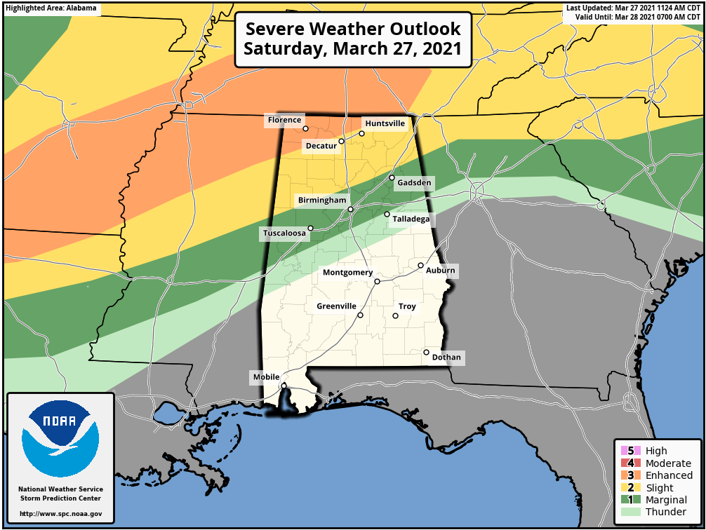
An Enhanced Risk (level 3 of 5) continues for the extreme north and northwestern parts of North Alabama, a Slight Risk (level 2 of 5) continues for the rest of North Alabama and into the extreme north and northwestern parts of Central Alabama, and a Marginal Risk (level 1 of 5) continues for an area stretching from the southern end of the Slight Risk to just south of the I-59 corridor. This day 1 Severe Weather Outlook goes through the rest of today and until 7:00 am Sunday morning.
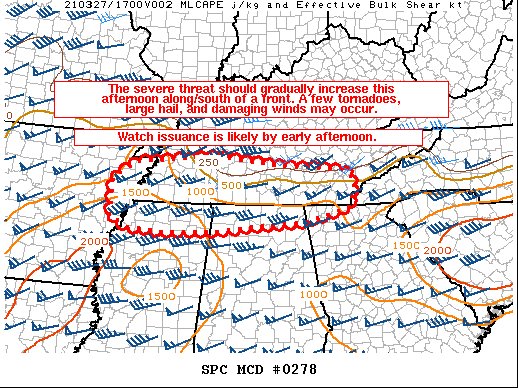
Some thunderstorms may develop and move across the extreme northern parts of North Alabama that may pose the potential for a few tornadoes, damaging winds, and large hail during the afternoon and into the evening hours. The Storm Prediction Center is likely to issue a Tornado Watch probably within the next 60-120 minutes.
For the rest of North/Central Alabama, no severe weather is expected until after the cold front gets its act together and starts to move into the northwestern parts of the area after midnight and slowly moves eastward through the pre-dawn and into the mid-afternoon hours on Sunday.
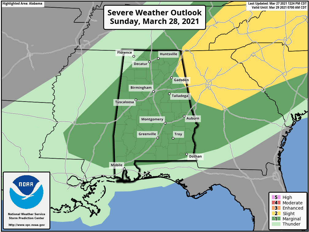
A Marginal risk is up for nearly all of North/Central Alabama for Sunday, with the exception of the northwestern corner (no risk), and the extreme northeastern corner as those locations are under a Slight Risk. Tornadoes, damaging winds, and large hail will be possible. The good news is that the line of storms will be in a weakening phase as it moves across the area on Sunday, so the threats will be lowering once it passes the I-59 corridor.
The main window for strong to severe storms with the main line will be from Sunday at 12 am through 10 am for locations along and north of the I-59 corridor, from 9 am to 4 pm for locations from the I-59 corridor down to the I-85 corridor, and from 2 pm to 6 pm for locations along and south of the I-85 corridor.
Today’s highs will top out in the mid-70s to the mid-80s across the area, then dropping back into the lower 60s to the lower 80s for Sunday.



