


WARM NOVEMBER AFTERNOON: Temperatures are generally in the 75-82 degree range across Alabama this afternoon, around ten degrees above average for early November. No rain on radar, and we stay dry tonight.
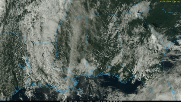
Tomorrow will be mostly dry, although a few showers will show up over the southern third of the state by afternoon.
WEDNESDAY: An upper trough/cold front will bring rain and thunderstorms into the state Wednesday. With weakening dynamic support, for now the threat of severe thunderstorms looks low. Rain amounts will be in the 1-2 inch range over the northern third of the state, with locally heavier amounts. Totals near one inch are likely for the central counties, and South Alabama will see generally 1/2 inch or less.
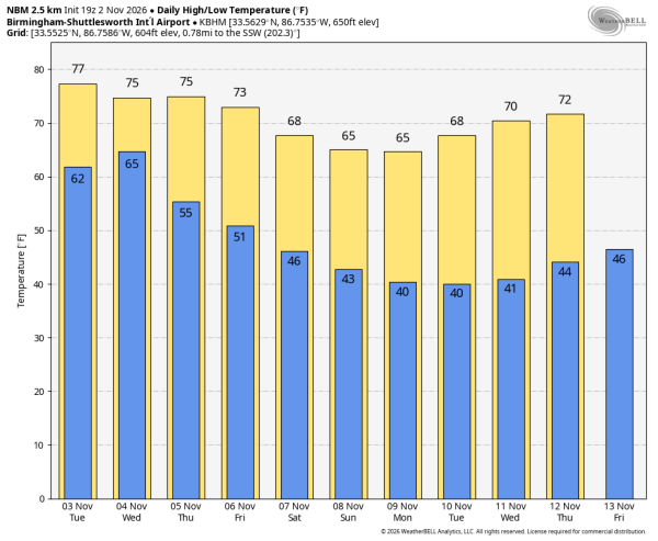
Expect a clearing sky Thursday, and the weather looks rain-free Friday through the weekend with a cooling trend. By Saturday and Sunday highs will be in the 60s, lows in the 40s for most communities.
Long range model guidance suggests we could see the first widespread frost of the season for the northern half of Alabama around November 10-11… See the video briefing for maps, graphics, and more details.
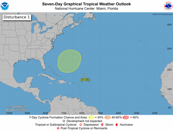
TROPICS: An area of low pressure is likely to form along a weakening frontal boundary a few hundred miles northeast of the Bahamas in a couple of days. This system could acquire some subtropical characteristics late this week while it drifts over the western Atlantic. The chances of subtropical development should end by the weekend when the system is expected to move eastward or northeastward into unfavorable environmental conditions.
Chance of development is 30 percent. No tropical storms are expected near the Gulf for at least the next 7-10 days.
FOOTBALL WEATHER: Auburn hosts Arkansas Saturday at Jordan-Hare Stadium (11:45a CT kickoff)… the sky will be sunny with temperatures in the mid to upper 60s.
Alabama will be in Baton Rouge to play LSU (2:30p CT kickoff)… it will be a sunny day there with temperatures in the mid 70s during the first half, falling into the upper 60s by the final whistle.
The weather looks excellent for all of the games played in Alabama Saturday; a clear sky with a high between 65 and 70 degrees. For evening games temperatures will fall quickly into the 50s.
ON THIS DATE IN 1966: Nashville was shocked by an unexpected early-season “sneak snow” that dropped over 7 inches of snow across the region from November 1–3. Huntsville recorded 4 inches of snow, standing as the city’s earliest measurable snowfall of 1 inch or greater on record. Other North Alabama areas saw heavier localized amounts, including roughly 6.5 inches in Madison, 6 inches in New Market, and 5 inches in Haleyville. Measurable or trace snow pushed as far south as Birmingham, and rare early snowflakes were even observed near Mobile.
Look for the next video briefing here by 6:00 a.m. tomorrow…



