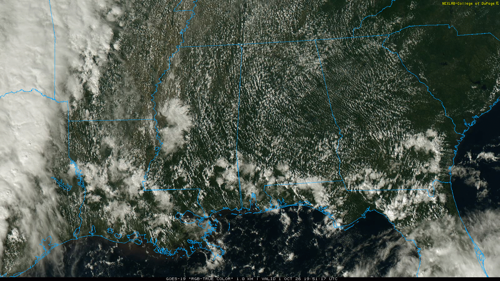
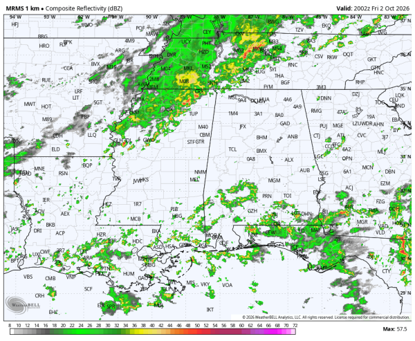
RADAR CHECK: Scattered showers and a few thunderstorms are over the southern half of the state this afternoon, and we also note showers over the northwest corner of the state west of the Shoals. Highest risk of rain tonight will be over the western half of the Tennessee Valley, and over South Alabama. Away from the showers temperatures have soared into the low 90s over parts of West Alabama this afternoon.
Here are the key messages for the weekend.
*The most widespread rain across Alabama tomorrow will be over the southern quarter of the state, especially near the coast. For North and Central Alabama, scattered showers are possible, but the rain won’t be widespread or heavy. In fact the sun could break out at times tomorrow pushing afternoon temperatures into the 87-91 degree range.
*We expect periods of rain statewide on Sunday. Not raining all day, but a decent part of the day. Some thunder is possible, but there is no risk of severe thunderstorms. Temperatures will hold in the 70s all day due to clouds and rain.
*Rain amounts for far South Alabama could exceed 3 inches between now and Sunday night. Amounts will be in the 1-2 inch range for the central counties, with generally around one inch for North Alabama.
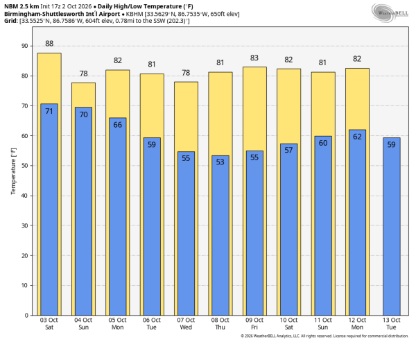
NEXT WEEK: A few lingering showers are possible Monday over the southern part of Alabama, otherwise the week looks rain-free with mostly sunny warm afternoons and clear cool nights. See the video briefing for maps, graphics, and more details.
TROPICS: Showers and thunderstorms associated with a trough of low pressure (the remnants of former Tropical Storm Fay) located several hundred miles southeast of Bermuda have become less organized during the past several hours. Dry air and strong upper-level winds are expected to prevent significant re-development while it moves north-northwestward at 5 to 10 mph to the east of Bermuda. Any formation chances should end tomorrow due to very strong upper-level winds. Chance of development is only 10 percent.
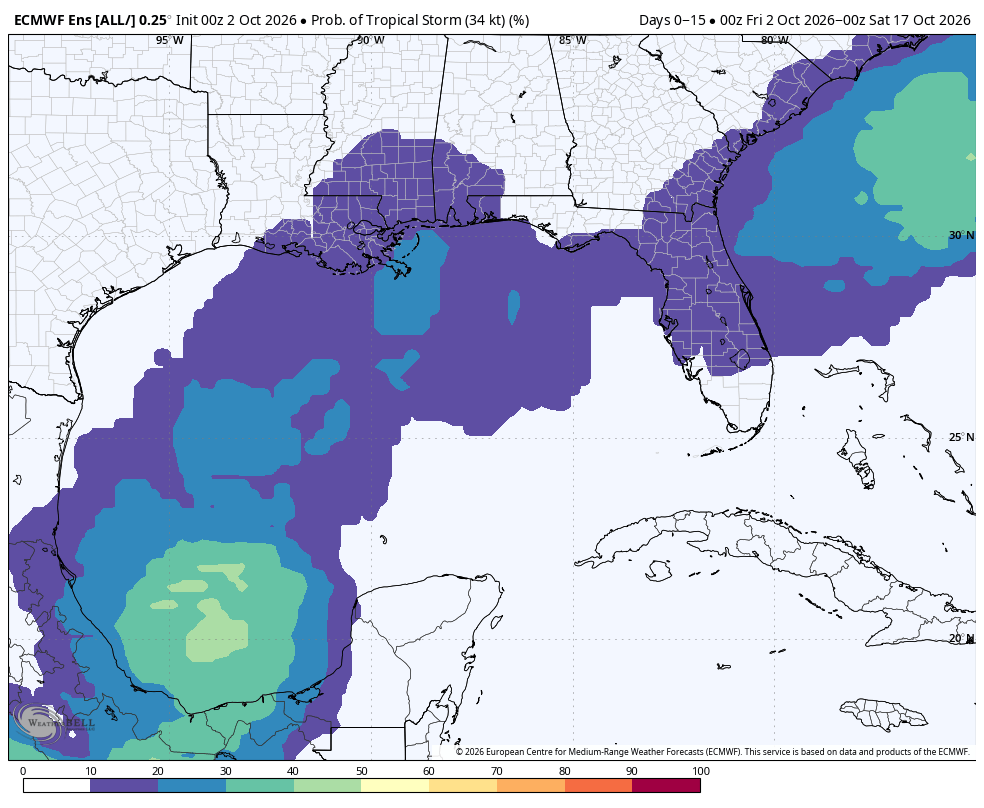
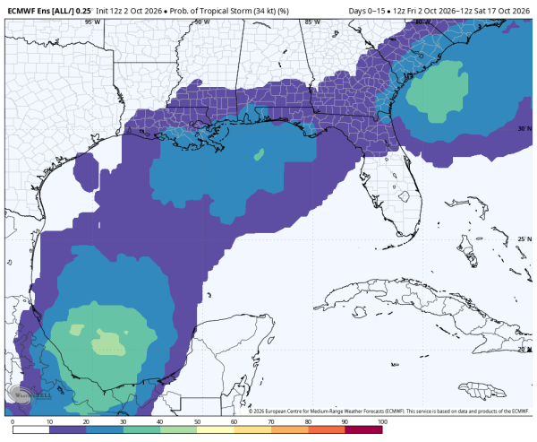
Tropical storm formation is not expected across the Atlantic basin for the next seven days. We continue to see some signal of potential development over the far Southwest Gulf late next week, but probabilities have come down.
FOOTBALL WEATHER: Alabama travels to Starkville to take on Mississippi State tomorrow (11a CT kickoff). A shower is certainly possible, but much of the game should be rain-free. Temperatures will be in the 80s.
Auburn is also on the road; they play Tennessee in Knoxville (2:30p CT kickoff). A shower is possible, but much of the afternoon is now looking dry. Temperatures will hover around 80 degrees during the game.
UAB will host Samford at Protective Stadium in Birmingham tomorrow (2:30p CT kickoff). A shower is possible during the game, but the rain won’t be widespread and much of the afternoon should be dry. Temperatures will be in the mid to upper 80s at kickoff.
Tuskegee, Alabama A&M, South Alabama, West Alabama all have home games (Alabama A&M plays in Mobile); a few showers are possible at each stadium.
ON THIS DATE IN 1898: A Category 4 hurricane made landfall in Georgia. This is the most recent major (Cat 3 or stronger) hurricane to make landfall in Georgia. It made landfall on Cumberland Island in Camden County, Georgia, causing record storm surge flooding. The hurricane caused heavy damage throughout the region, and killed at least 179 people. Impact was most severe in Brunswick, where a 16 ft storm surge was recorded.
Look for my next video briefing here by 6:00 a.m. Monday… enjoy the weekend!