Weather charts used to come into the National Weather Service offices on these old wet fax machines. They were sepia toned on this thin paper. They were hole punched and mounted on peg boards. Don’t get me wrong, I love all of the computer displays we enjoy today, but those old charts have a special place in m heart. I thought I would display today’s highs on the old DIFAX format.
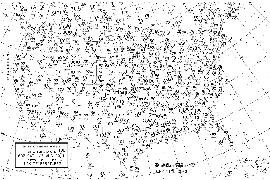
It was hot across Central Alabama today. A cold front pushed through Central Alabama, but you couldn’t tell it by the thermometer. In fact, Friday tied Thursday as the hottest day of the year so far at Birmingham when the mercury rose to 100. It was 102 at Tuscaloosa (a record), 100 at Anniston (a record) and 102 at Pinson (guess what, a record). The 102 at Montgomery tied the record for the date.
Slightly cooler and drier air will be filtering into Alabama behind the front Saturday, with dewpoints falling to near 60 by the afternoon. Throw in a nice northerly breeze that will be blowing at 10-15 mph, and you have the recipe for a fairly decent late August day. Temperatures will still be above normal, averaging 93-95. Skies will be mostly sunny.
Sunday will be even a little better. Maybe a degree cooler, even a little less humid, bright blue skies and a breezy north wind. Highs will average 92-94. We will start off in the upper 60s Sunday morning, and Sunday night lows will be in the middle 60s.
Monday and Tuesday will be dry as a northerly flow continues to pump in dry air. Highs will be in the lower 90s and lows will be in the middle and upper 60s.
As high pressure settles over the Mid-Atlantic in the wake of Hurricane Irene, we will start to see an easterly flow off the Atlantic Ocean into Alabama. This will allow us to reintroduce a slight chance of afternoon and evening showers and storms starting Wednesday through the end of the week. Highs will be in the lower 90s. Lows will be in the lower 70s.
No signs of any real rain chances for the next 14 days. That’s not good news.
A LITTLE INFO ON IRENE
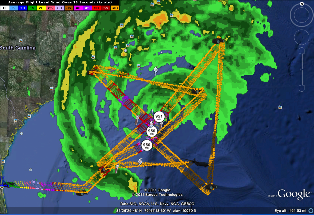
Two recon planes are flying through Irene right now and a Gulfstream jet is flying around the storm at high altitudes gathering dense data to input into the computer models. Here is a current depiction on Mission 29, the Air Force C-130J designated AF308 that will be generating a center fix shortly for the 10 p.m. CDT advisory. At last report, Irene had top winds of 100 mph and a central pressure of 950 mb. It has started the expected slight turn to the north northeast.
At 8 p.m. CDT, winds gusted to 47 mph at Wilmington NC and 39 mp at Cape Hatteras. The barometer was down to 29.46 inches at Wilmington. Tropical storm force and some hurricane force winds will continue to overspread eastern North Carolina tonight. There have also been tornado warnings. We will have the latest information on Irene around 10 p.m.
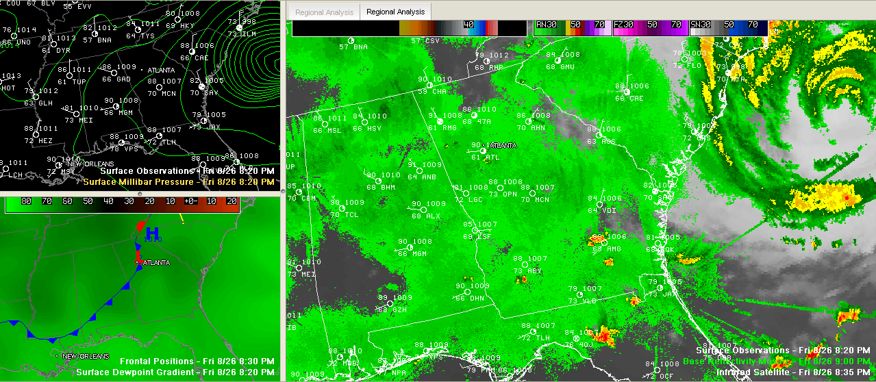
In Alabama, temperatures were still in the 80s and dewpoints in the upper 60s to near 70. But not very far to the north, the dewpoint at Nashville is 57F, so hang on, help is on its way. Winds are out of the northwest as we experience the circulation of Irene. Just not any of her rains. That’s obviously not rain on the radar over Alabama on the SimuAWIPS display, just anomalous propagation, or false returns.