


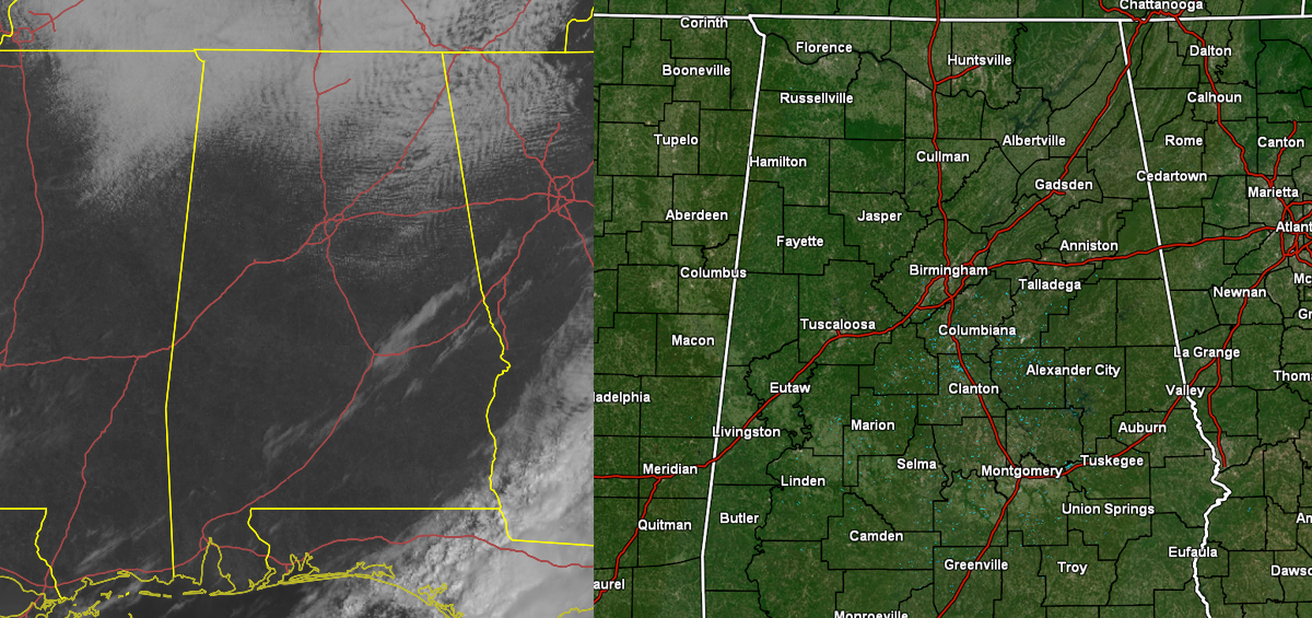
JUST BEFORE 11 AM: We continue to have some pesky cloud cover over the northern parts of North/Central Alabama and a stream of clouds near the I-85 corridor, but other than that, skies have become sunny across the area. Temperatures are still rather cool across the northern parts of the area at 10:40 am, but becoming mild in the southeast.
REST OF TODAY & TONIGHT: We were in the upper 40s to the lower 60s across the area. Haleyville was the cool spot at 48º. Eufaula was the warm spot at 63º. Birmingham was sitting at 52º. Those clods should mostly move out of the area by sunset, and highs will reach the 60s across the area. Skies will clear out by tonight and lows will drop into the mid 30s to the lower 40s.
SUNDAY’S WEATHER: Sunday will be a brilliant and beautiful day across Central Alabama, with mild temperatures. Highs will be in the upper 60s to the lower 70s underneath mainly sunny skies.
A strong surface low will begin to approach the area on Tuesday bringing with it rain and thunderstorms, and with the setup in place, strong to severe storms will be possible. At 4 pm Tuesday, the storms will be at the state line and will slowly progress eastward to the I-59 corridor by 4 am Wednesday, and in the process of leaving the area by 4 pm Wednesday afternoon. All modes of severe weather will be possible. Highs on Tuesday will be in the lower 70s to the lower 80s, and slightly dropping back into the lower to mid 70s for Wednesday.
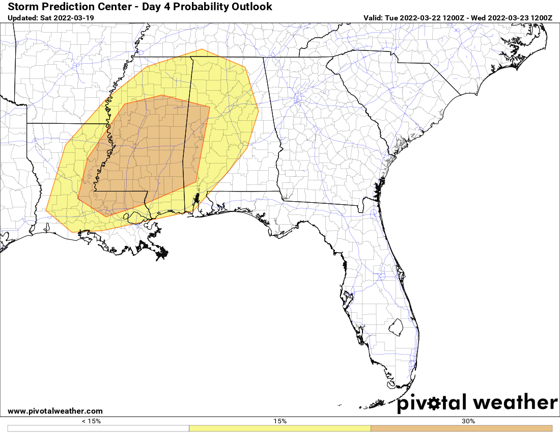
An ENHANCED RISK is already up on Tuesday’s severe weather outlook for locations south and west of a line from roughly Millport (Lamar Co.) to Windham Springs (Tuscaloosa Co.) to Linden (Marengo Co.). A SLIGHT RISK is up outside of that and stretches as far east as just south of Hazel Green (Madison Co.) to Woodville (Jackson Co.) to Lineville (Clay Co.) to just east of Montgomery to Fort Deposit (Lowndes Co.).
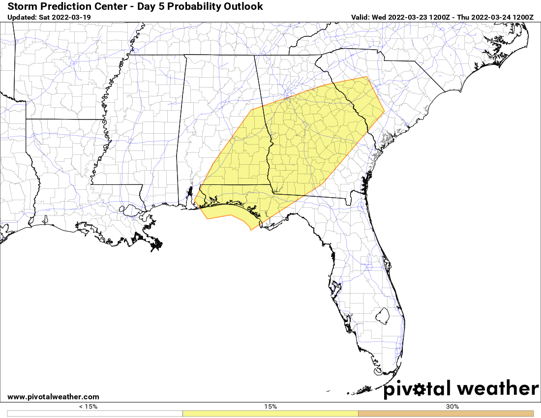
Wednesday’s outlook has a SLIGHT RISK up for locations south and east of a line from Wedowee (Randolph Co.) to Millbrook (Elmore Co.) to Macedonia (Lowndes Co.).
We’re still too far out for the high-resolution models to be in view for this system, so it is still a little too early to pinpoint the magnitude, locations, and timing. Once those start to come in, we’ll get a much better look at what to expect. Just go ahead and refresh those supplies and keep your safe place cleared out. This is a system that we will need to bear watching, and the forecast may change, and severe risks may increase. We’ve got you covered.



