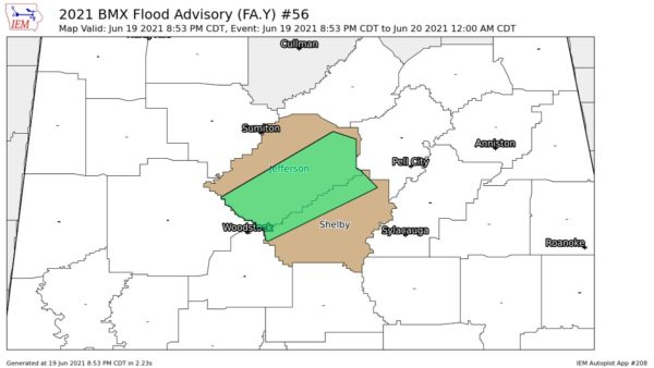
Seems like it is raining over the whole wide world tonight and here in Alabama, it is a wind-driven rain with strong SE winds.
But it is not raining everywhere. In fact, as midnight approached, nearly the west half of Alabama was getting a break. Exception: Moderate to heavy showers lagging behind over Walker and Winston County.
Rain continues extensive over the East half of Alabama but it was moving east. The Mobile area got well over three inches of rain earlier tonight within about two hours. A number of roads in the are were flooded.
SOME WIND REPORTS TONIGHT
* Gusts to 45 mph at the downtown Birmingham Skycam atop the Daniel Building.
* Gusts to 32 mph at the Cullman Skycam
* Gusts to 31 mph at the Gadsden Skycam
* Gusts to 38 mph atop Mt. Cheaha (a chilly 46 degrees)
* Gusts to 63 mph at the Inverness Skycam
ALABAMA RAINFALL SO FAR TONIGHT
0.30 in West Hueytown
1.06 at Taylorville (south of Tuscaloosa)
1.68 at Fayette*
0.37 at Riverchase (3340 Weather Office)
1.10 at the Demopolis Skycam
0.48 in Vinemont (North Cullman County)
1.85 at Cottondale (east of Tuscaloosa)
1.74 at Moundville (North Hale County)
0.36 in Trussville
0.73 in Cordova
1.29 at Carbon Hill (Extreme NW Walker County)
1.36 at Haleyville
1.08 at Jasper
0.45 at Pell City and Sylacauga
0.52 at Cullman (3340 Skycam)
0.23 at Gadsden Skycam
1.13 at Hamilton Skycam
0.60 at Inverness Skycam
0.30 atop Mt. Cheaha (Skycam)
3.33 + inches at Mobile Airport
THE FAYETTE RAINFALL STORY
The 1.68 total so far tonight brings the total for the last five weeks to a whopping 10.80 inches!