


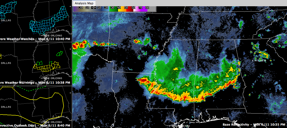
Our intense line of storms has weakened as it has pushed into South Central Alabama.
No severe thunderstorm warnings for the NWS Birmingham coverage area.
There is a flash flood warning for parts of of Shelby and Talladega Counties til 1130 p.m. It probably will be allowed to run until its expiration time.
There is still a severe thunderstorm watch until 11 p.m. for Autauga, Chambers, Coosa, Dallas, Elmore, Lee, Lowndes, Macon, Montgomery and Tallapoosa Counties.
Lots of reports of trees down across West Central and Central Alabama tonight. Many on houses.
Alabama Power reports as of 10:39 p.m.: We have restored power to about 28K customers. We are down to 100K statewide, a little less than 65K in Birmingham and 30K to the west. Follow them @alabamapower.
Storms developing between Little Rock and Memphis will intensify and move into Louisiana and Central Mississippi overnight. They should stay west of Central Alabama. Could see an isolated storm into West Central sections overnight around Marion or Lamar Counties.
Scattered showers and storms will develop Tuesday afternoon ahead of a weak cold front. A couple of them could be strong, but I don’t think severe weather will be widespread like today.



