


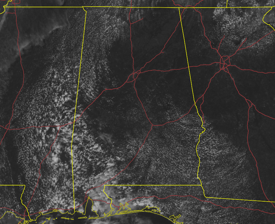
A BRIEF CHECK JUST AFTER 1:00 PM: What a wonderful way to start off the first Saturday of the college football season in the state, as skies are mostly sunny and temperatures in the 80s across Central Alabama. The warm spot was Demopolis at 88 degrees, while the cool spot was Auburn at 80 degrees. Birmingham was at 85 degrees.
FORECAST FOR THE REST OF THE DAY: It will continue to be a fantastic day across the area, with plenty of sunshine and lower humidity values. While those afternoon highs will be making it up into the upper 80s to the lower 90s, it will be a more comfortable heat than what we are accustomed to in Central Alabama for late summer. For tonight, skies will be clear, with lows in the 60s.
ALABAMA & AUBURN GAMES: For the Alabama game in Atlanta, they will be playing with the roof open. While the temperature will be controlled in the stadium, it will be sunny, with the high reaching around 87 degrees. Auburn will be at home on the plains with a 6pm kickoff. Skies will be sunny, with the temperature starting off around 81 and steadily dropping into the lower 70s by the final whistle.
SUNDAY’S WEATHER: Much of the day on Sunday will be rather nice once again with mostly sunny skies and highs in the mid 80s to the lower 90. A cold front will eventually move slowly into the northern parts of the area, bringing shower and thunderstorm chances for the extreme northwester parts of the area by the mid to late afternoon hours and continuing to move southeast through the rest of the day. Locations along and south of I-59 look to stay dry.
LABOR DAY: The cold front will continue to slowly move deeper into the area and eventually stall out right around the I-20 corridor. That will keep shower and thunderstorm chances in the forecast for Labor Day. Highs will be in the lower 80s to the lower 90s.
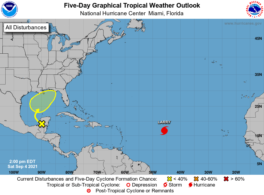
THE TROPICS: We have a weak surface trough over portions of the western Yucatán Peninsula
of Mexico is producing disorganized shower and thunderstorm activity. The disturbance is forecast to move northwestward over the southwestern Gulf of Mexico on Sunday, then moved northward or northeastward over the western or central Gulf of Mexico Monday and Tuesday. Unfavorable upper-level winds are expected to limit development through Monday, but environmental conditions could become marginally favorable for some gradual development on Tuesday or Wednesday. Regardless of development, locally heavy rains are possible over portions of the Yucatán Peninsula and northern Central America through Sunday. If this system does get better organized, we could see some effects from it in portions of Central Alabama by midweek.
* Formation chance through 48 hours … low … near 0 percent.
* Formation chance through 5 days … low … 30 percent.
We also have Larry, which is a category 3 major hurricane, located around 1,600 miles to the southeast of Bermuda as of the 1 pm advisory. Larry is moving toward the west-northwest near 15 mph. A gradually slower west-northwest to northwest motion is expected during the next few days. Maximum sustained winds have increased to near 125 mph, with higher gusts. Additional strengthening is forecast over the next day or two. Larry is expected to remain at major hurricane strength through the early part of next week.
Significant ocean swells generated by Larry’s growing wind field are expected to reach the Lesser Antilles tomorrow, and then spread westward to portions of the Greater Antilles, the Bahamas, and Bermuda on Monday and Tuesday. These swells could cause life-threatening rip currents and high surf conditions. Large swells are also likely to spread to the east coast of the United States by midweek.



