


Guest Contributor Sheldon Kusselson has prepared a special satellite interpretation update that I think you will enjoy reading.
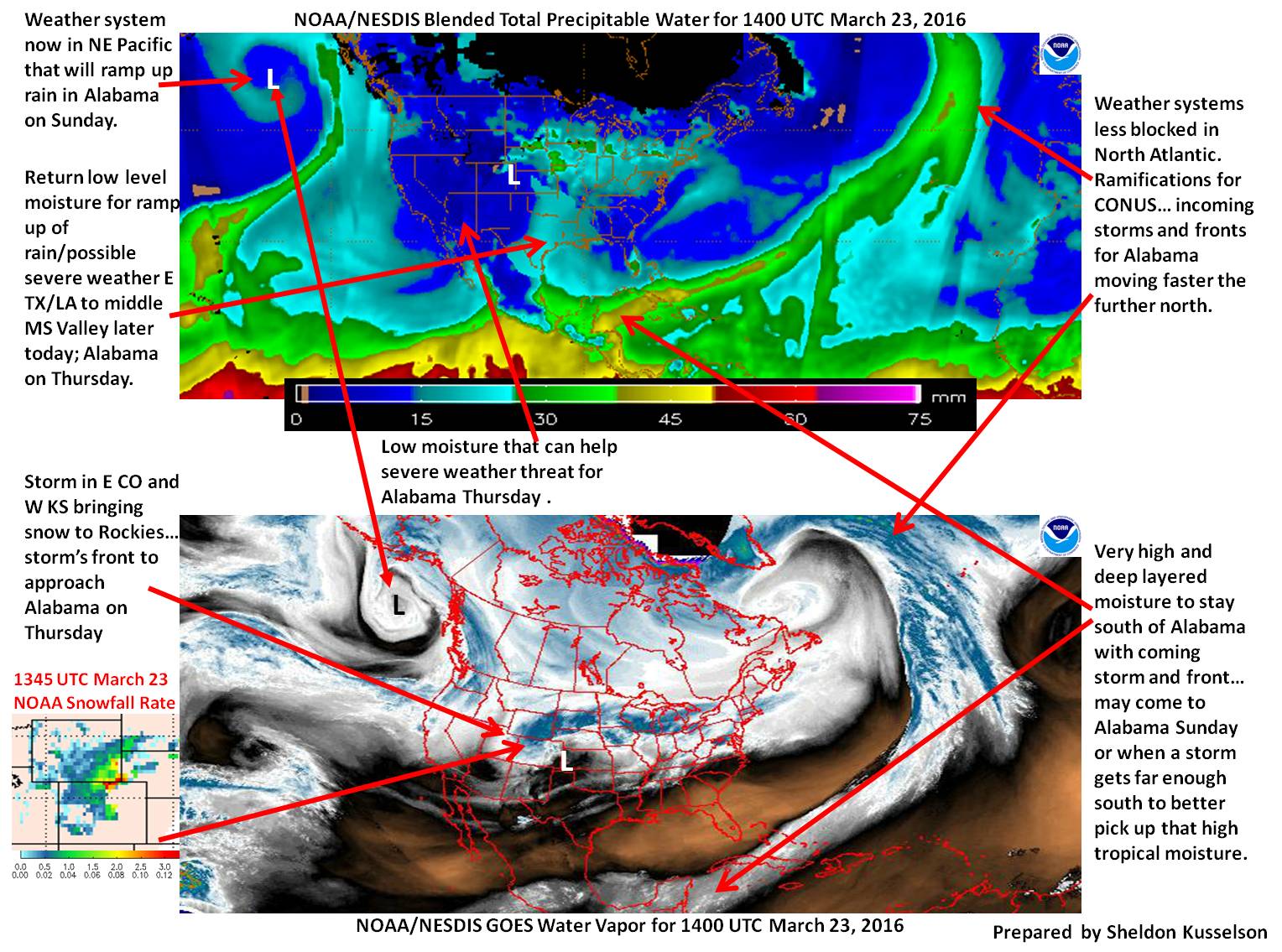
Click image to enlarge.
As he points out in his graphic, (make sure to enlarge it by clicking on it) the moisture over eastern Texas and Louisiana will provide the fuel for our severe weather tomorrow.
The dry air over the southwestern U.S. will enhance our severe weather threat tomorrow as it overspreads the warm, moist air in the low levels of the atmosphere. This is because drier air aloft leads to higher instability and also produce more favorable conditions for strong downdrafts.
As Sheldon points out, we are in a more progressive pattern, because there aren’t any blocking systems downstream from us over the Atlantic and Europe. Storms can move more freely to the east, so we get more frequent, faster moving systems.
The system won’t have as much moisture as past systems, so flooding will not be as big a threat. And as a last note, Sheldon shows deeper moisture lurking over the southern Gulf of Mexico and western Caribbean that stronger storms will be able to tap for coming storms.



