


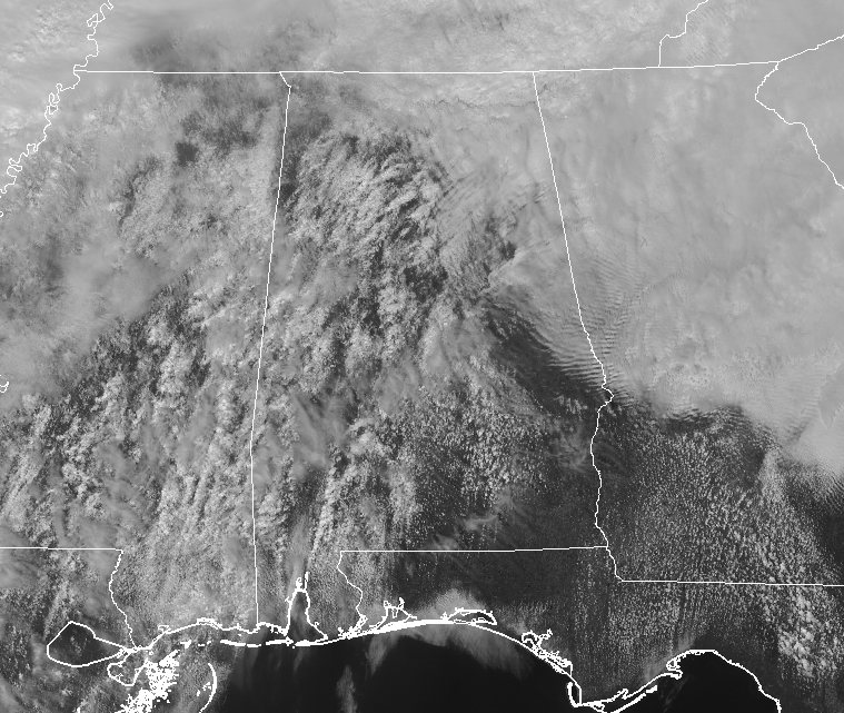
While it is great to see some sunshine after so many days of gloomy skies and rain, today would be a day that less sunlight will be better. Conditions will continue to destabilize throughout the afternoon hours and any sunlight we get down to the surface will only help to destabilize the atmosphere even quicker.
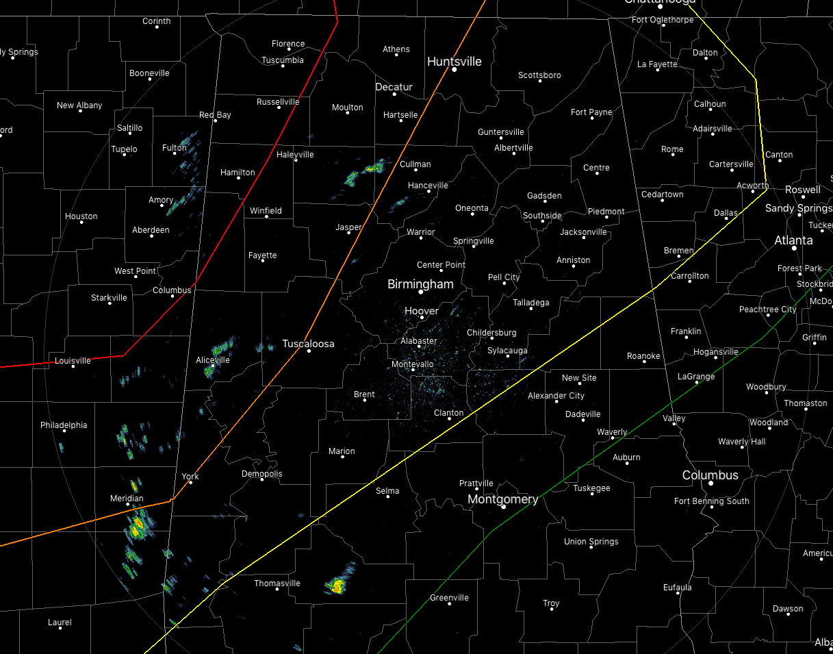
At 12:25 pm, we’re starting to see a few isolated showers popping up over the western and southwestern parts of the area, but these are more of your typical light showers. Temperatures are already up in the lower to mid-80s in the southern parts of the area, with Eufaula topping out at 84 degrees so far. Up in the Tennessee River Valley, we are seeing readings in the 50s and 60s, with Fort Payne being the cool spot at 53 degrees. In-between those two areas, temperatures are in the 60s and 70s. Birmingham was at 72 degrees, Tuscaloosa was at 79 degrees, and Anniston was at 64 degrees.

SPC continues a MODERATE RISK of severe storms for parts of North/Central Alabama west of a line stretching from Vernon (Lamar Co.) to Phil Campbell (Franklin Co.) to Lexington (Lauderdale Co.).
SPC continues an ENHANCED RISK of severe storms for parts of North/Central Alabama extending east from the moderate risk to west of a line stretching from Cuba (Sumter Co.) to Northport (Tuscaloosa Co.) to Restone Arsenal (Madison Co.).
SPC continues a SLIGHT RISK of severe storms for parts of North/Central Alabama extending east from the enhanced risk to west of a line stretching from Sweet Water (Marengo Co.) to Clanton (Chilton Co.) to Ranburne (Cleburne Co.).
SPC continues a MARGINAL RISK of severe storms for parts of North/Central Alabama extending east from the slight risk to west of a line stretching from Fort Deposit (Lowndes Co.) to Tallassee (Elmore Co.) to Waverly (Chambers Co.).
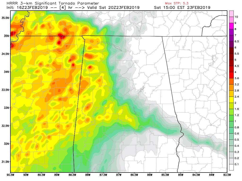
HRRR STP values valid at 2:00 pm today.
We could see storms forming as soon as 2:00 pm over the western parts of the area. There is a possibility that these could become strong as instability will have already started climbing over that part of the area. Shear will be present as well. Significant Tornado Parameters will be increasing as well, reaching as high as 3.7 in spots over the northwestern parts of the area.
Main threats in the moderate and enhanced risk areas include damaging thunderstorm wind gusts up to and in excess of 70 MPH, large hail of 1-inch in diameter or greater, and tornadoes (some of which could be the strong, long-track variety). Threats in the slight risk area will be from damaging thunderstorm wind gusts up to 60 MPH, hail up to or exceeding 1-inch in diameter, and tornadoes. Threats for the marginal risk area will be from isolated damaging thunderstorm wind gusts up to 60 MPH, hail up to 1-inch in diameter, and one or two brief spin-up tornadoes.
The ingredients will be there during the mid-afternoon hours, but the question will be “will we have any storms actually fire up at that time?” We’re at the point now where we’ll have to wait and see.
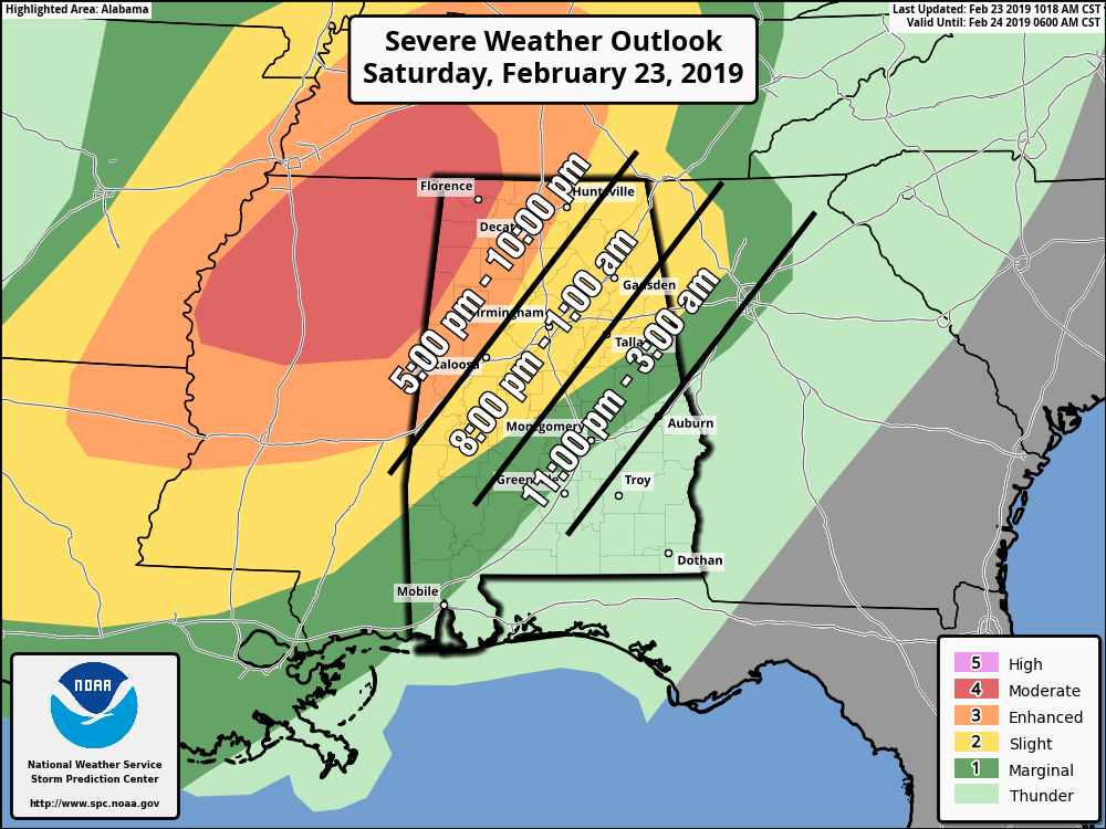
At this point, we’ll go with the timing in the above graphic. The window for stronger to severe storms will be 5:00 pm – 10:00 pm for locations mainly in the moderate and enhanced risk areas, 8:00 pm – 1:00 am for locations mainly in the slight risk area, and 11:00 pm – 3:00 am for locations mainly in the marginal risk area. Severe storms are not expected in the southeastern parts of the area as the line will have lost its dynamic support and the atmosphere will be more stable.
Now is the time to have your emergency kit ready to go along with your emergency plan just in case your location goes under a warning later today or tonight. You still have a little time before the storms move in to go out and grab fresh batteries, flashlights, an air horn, and/or a weather radio. The good news is that all of those items can be purchased tax-free today and tomorrow as it is the Severe Weather Safety Preparedness Tax-Free Holiday. Have those batteries charged in your smartphones and download the ABC 33/40 app so you can watch severe weather coverage if you lose power or TV signal.
We’ll continue to have updates through the day and night. Check back often.



