


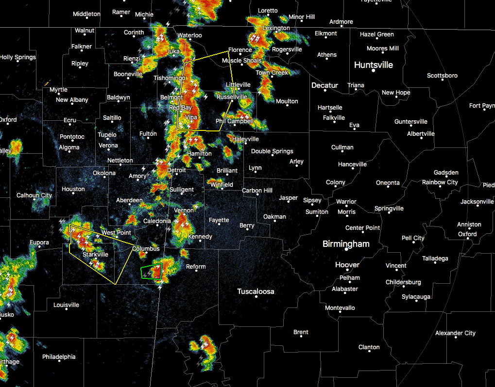
The HRRR model that I used during my midday post nailed the development of the strong to severe storms that are moving into northwest Alabama from northeastern Mississippi. There was nothing on the radar at the time that I was working on the post, but those started firing right after 2:00 PM and was starting to affect the westernmost locations in that area just about 60-90 minutes later.
The lead cells are moving slower to the east than the ones that have a severe thunderstorm warning on them, but all of these cells are putting down torrential rain, gusty winds, and very dangerous cloud-to-ground lightning. Pretty much all of these cells are strong to severe, either having a severe thunderstorm warning or significant weather advisories issued on them.
It is not going to take much rain at all for flooding issues to start up again considering what happened through the morning hours, especially in Greene County. Another 0.50″-1.00″ of rain could occur with any one of these storms.
For the rest of Central Alabama, we are dry with sun breaking through to the surface.



