


RADAR CHECK AT 4:15 PM: So far throughout the day, most of the heavy rainfall has remained south of the I-20 and I-59/20 corridors, but the heavy showers and thunderstorms are continuing to slowly creep eastward as the cells in the line are expanding northward. The heaviest rainfall at this time can be seen from Demopolis over to Selma, then up through Billingsley and Rockford, and over through Alexander City and Roanoke. Another stronger cell, located over the southwestern parts of Shelby County, is producing very heavy rainfall, frequent cloud-to-ground lightning, and gusty winds up to and over 40 MPH.
The good news is that there have been no severe thunderstorm warnings at this point, and we have only received a couple of reports of minor damage to a building and a few trees downed near Eufaula.
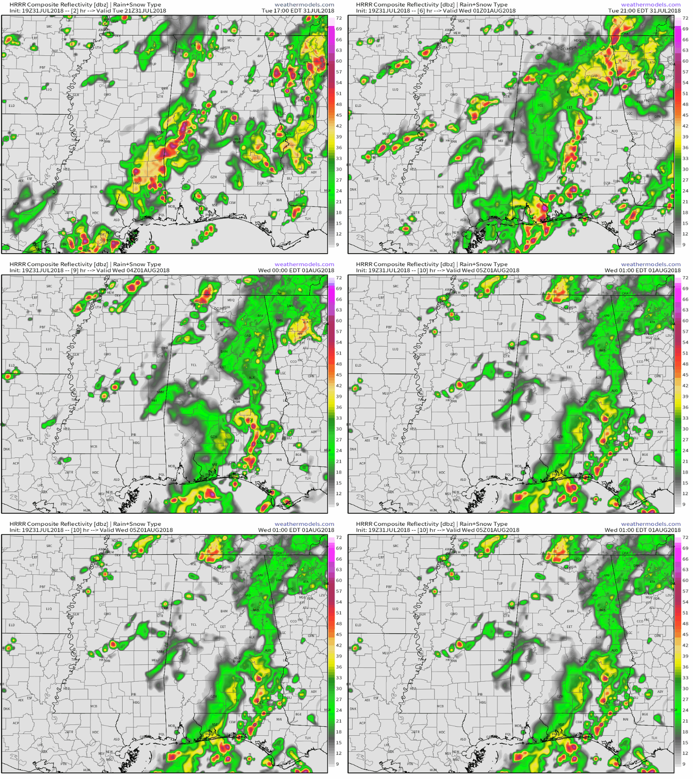
WHAT THE HI-RES MODEL SHOWS FOR TONIGHT: The latest HRRR Simulated Radar model run shows a band of heavy showers and thunderstorms will continue to move in from the southeastern parts of Mississippi into the southwest and western parts of Central Alabama throughout the rest of the afternoon and into the evening hours before coverage begins to diminish somewhat just prior to midnight. This run shows moderate to heavy storms impacting the cities of Tuscaloosa and Birmingham just before and during the 5 o’clock hour and persisting for at least 3-4 hours. This rainfall could be so heavy at times that localized ponding and flooding could occur in poor drainage areas and areas where water collects easily.
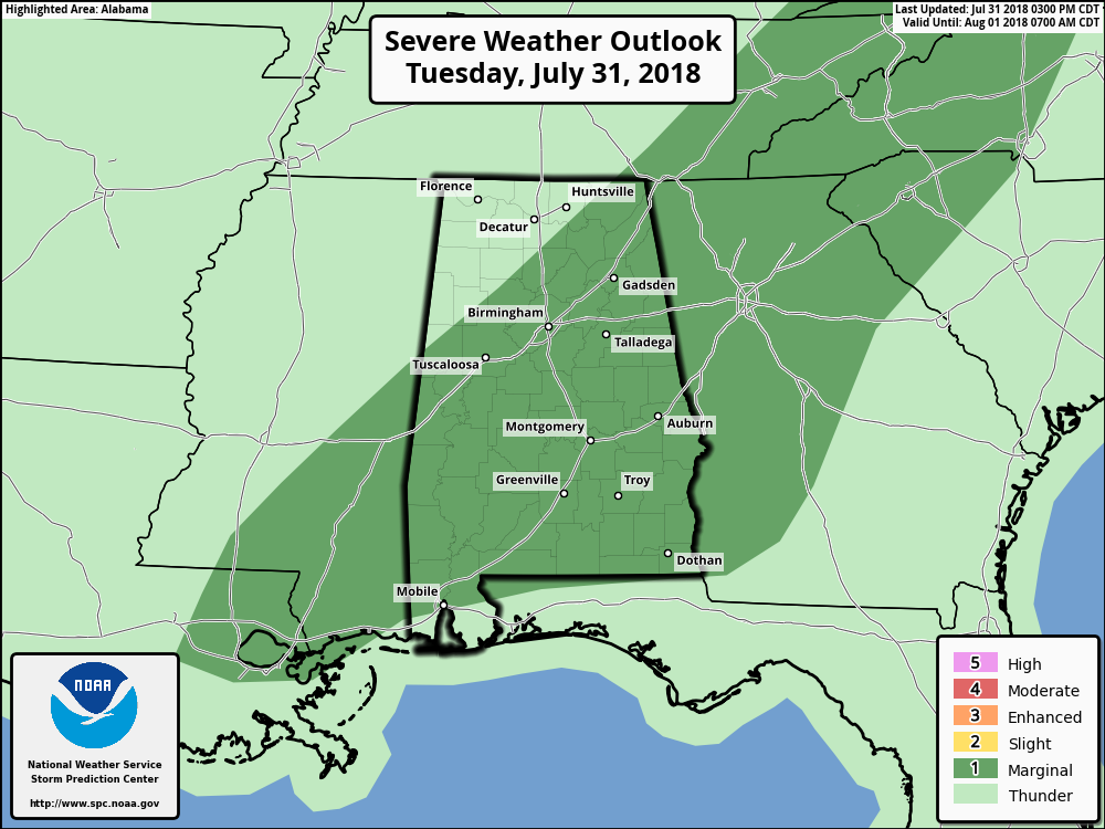
MARGINAL RISK FOR SEVERE STORMS CONTINUE: SPC continues a Marginal Risk of severe storms for all of Alabama south of a line from Reform (Pickens Co.) to Arley (Winston Co.) to Hytop (Jackson Co.), and north of a line from Tillmans Corner (Mobile Co.) to Daphne (Baldwin Co.) through the remainder of the day and into the overnight hours.
Storms will continue to become widespread throughout the remainder of the afternoon and into the early evening hours today. With sufficient instability coupled with adequate deep-layer shear, a few storm clusters that could produce locally gusty to damaging winds. The main threats for today will be from very heavy rainfall at times, along with dangerous cloud-to-ground lightning.



