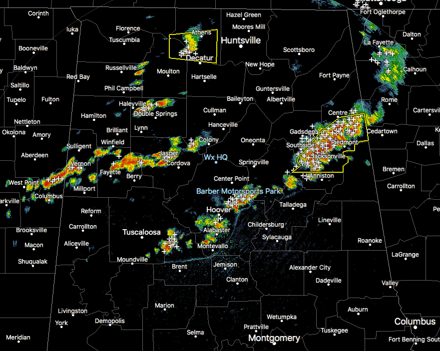
RADAR CHECK AT 4:05PM
Showers and storms have started to pop up back over the western and northwestern parts of the state, as the cold pool that I mentioned earlier has been worn away. Surface-based instability values have climbed back up into the 2500-3500 J/kg range over much of the northern-half of the state, and with current temperatures in the mid 80s to the lower 90s where it hasn’t rained yet, convective development will continue to occur for a little while longer. Precipitable water values in the 1.5-2.3 inch range, so if you’re caught under one of these strong storms, you can expect very heavy rainfall that could total up to an inch or more within a short time.
We currently have two separate severe thunderstorm warnings in effect in the state. One is for a discrete cell affecting parts of Lawrence, Limestone, and Morgan counties, and it goes until 4:30PM. The second is for a cluster of storms moving through Calhoun, Cherokee, and Etowah counties, and it goes until 4:30PM as well.
A new Severe Thunderstorm Warning for Calhoun, Cleburne, and Cherokee counties was just issued until 5:15PM, with the main threats being damaging wind gusts and some hail.
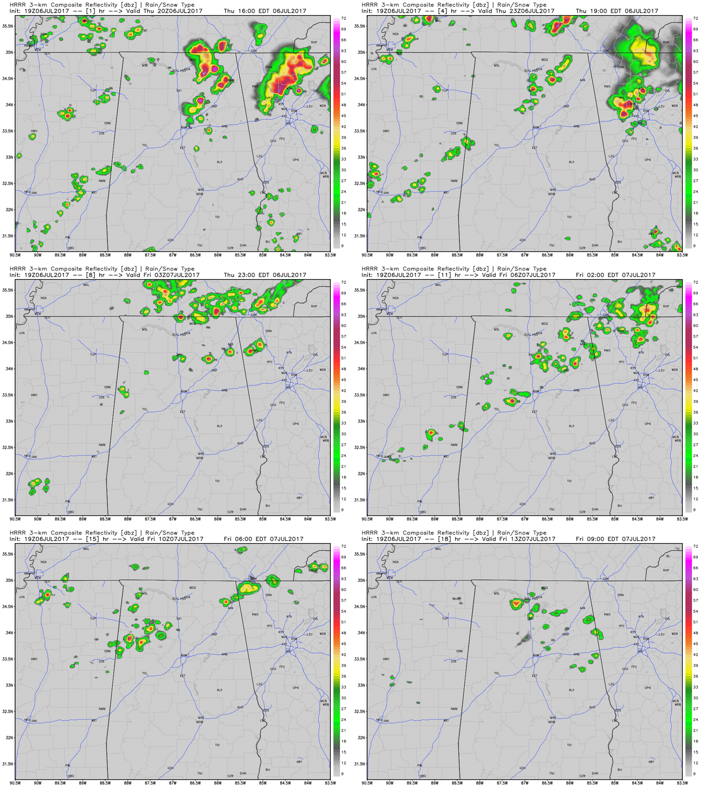
Both the HRRR and the WRF forecast models still show more development occurring and moving through the area throughout the evening and overnight hours. The animation is the HRRR through 8AM Friday morning, and as you can see, we’ll continue to have scattered storms affecting some parts of the area.
Once we lose the sunshine and convective heating, the risk for any storms to become severe will be greatly less, but a strong storm or two will remain possible.