


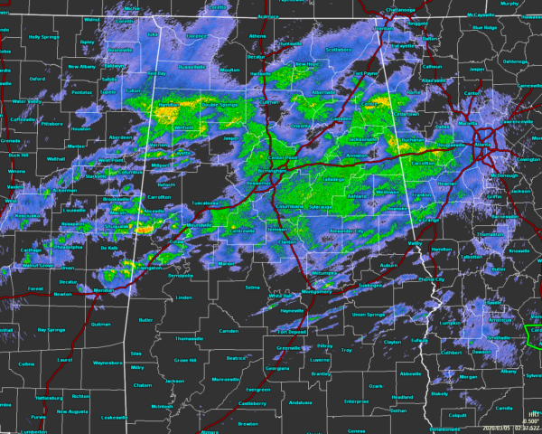
RADAR CHECK: As of 8:40 pm, we have most of the light to moderate shower activity over the northern two-thirds of North/Central Alabama while much of the southern third of the area is getting a decent break from the rainfall. Only a few scattered showers are occurring down in those parts of the area.
The latest HRRR keeps the shower activity widely scattered to numerous throughout the rest of the night and through the overnight hours. A few of these may get heavy at times, but most look to stay in the light to moderate range. By sunrise on Thursday morning, rain will be likely across all of the area, but there will be some dry spots in there at times as well. The good news is that much of the activity looks to be out of here and into Georgia by the late afternoon hours.
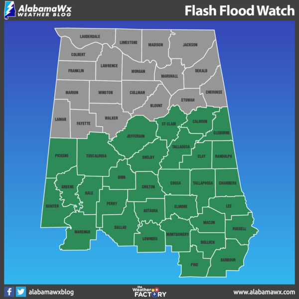
A FLASH FLOOD WATCH continues in effect for Autauga, Barbour, Bibb, Bullock, Calhoun, Chambers, Chilton, Clay, Cleburne, Coosa, Dallas, Elmore, Greene, Hale, Jefferson, Lee, Lowndes, Macon, Marengo, Montgomery, Perry, Pickens, Pike, Randolph, Russell, Shelby, St. Clair, Sumter, Talladega, Tallapoosa, and Tuscaloosa counties until 12:00 pm Thursday afternoon.
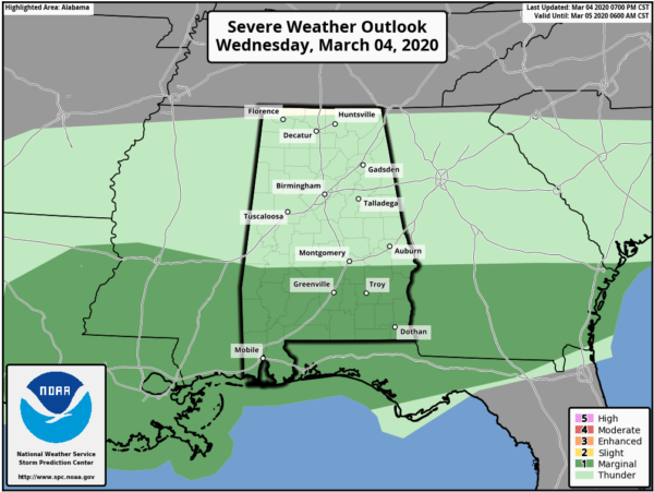
There continues to be a Marginal Risk for severe storms through the rest of the night through sunrise Thursday morning for the southern portions of the area. Isolated damaging winds up to 60 MPH and hail up to 1-inch in diameter are the main threats, but those will be unlikely as the instability looks to stay over the extreme southern parts of the Florida Panhandle and over the waters of the Gulf of Mexico.
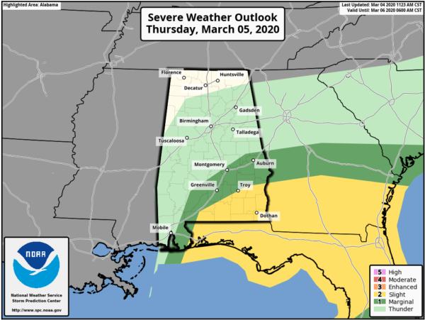
Starting at sunrise Thursday morning, SPC has outlined the southeastern parts of the area in a Marginal Risk while the southern halves of Pike and Barber counties are in a Slight Risk for severe storms. Once again, isolated damaging winds up to 60 MPH and hail up to 1-inch in diameter will be possible, along with a non-zero threat of a tornado or two.
We have to remember that we have now entered into the Spring Severe Weather Season for Alabama… We have to keep our eye on every system that moves through. As we saw with the tornadoes that occurred in Tennessee on Tuesday, your risk level doesn’t have to be all that high to have significant tornadoes. Please stay weather aware and keep your safety kits handy just in case your location goes under a warning.



