


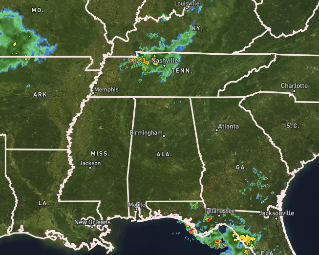
The regional radar look at 11:25 am shows that Alabama looks to be mainly free, but a few small showers have developed over a small portion of the Tennessee Valley. Heavier rain and storms are moving toward Nashville where there is a big race event happening in the middle of downtown. At this point all rain activity is pushing slowly to the east, but boundaries from this activity may push southward into the northern parts of the area later this afternoon and will be the catalyst for the development of scattered storms across Central Alabama.
Temperatures across the area were already up into the mid to upper 80s, and look to top out in the 92º-97º range for the afternoon high. Autauga, Bibb, Dallas, Elmore, Fayette, Greene, Hale, Lamar, Lowndes, Marengo, Montgomery, Perry, Pickens, Sumter, Tuscaloosa, and Walker counties are under a Heat Advisory until 9 pm tonight for the potential of heat index values reaching 105º or higher.
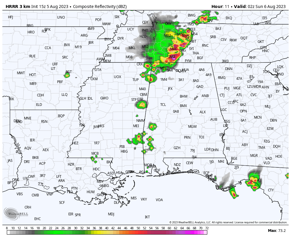
The latest run of the HRRR is showing an MCS moving eastward across Tennessee and the northern portions of the area (image valid at 9 pm tonight), with scattered pockets of showers and storms south of that. The WRF model run shows a larger MCS moving through the area stretching from the AL/TN state line down through Chilton County, with scattered activity south of that.
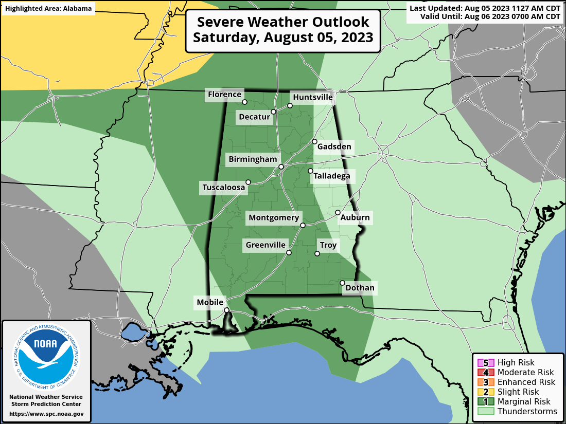
No change in the severe weather outlook across Central Alabama, as a Marginal Risk is up for the entire area east of a line from Scottsboro to Gadsden to Alexander City to just west of Clayton in Barbour County. The threat will be from damaging straight line winds with any storm that goes severe; but, tornadoes and hail do not appear to be a threat with today’s activity.
We’ll also have to watch for strong to severe storms through Tuesday, with Monday and Tuesday now looking like the best possibilities for severe storms. Damaging winds and large hail will be the threats with that activity as we’ll have a cold front pushing into and stalling out over Central Alabama. #StayWeatherAware



