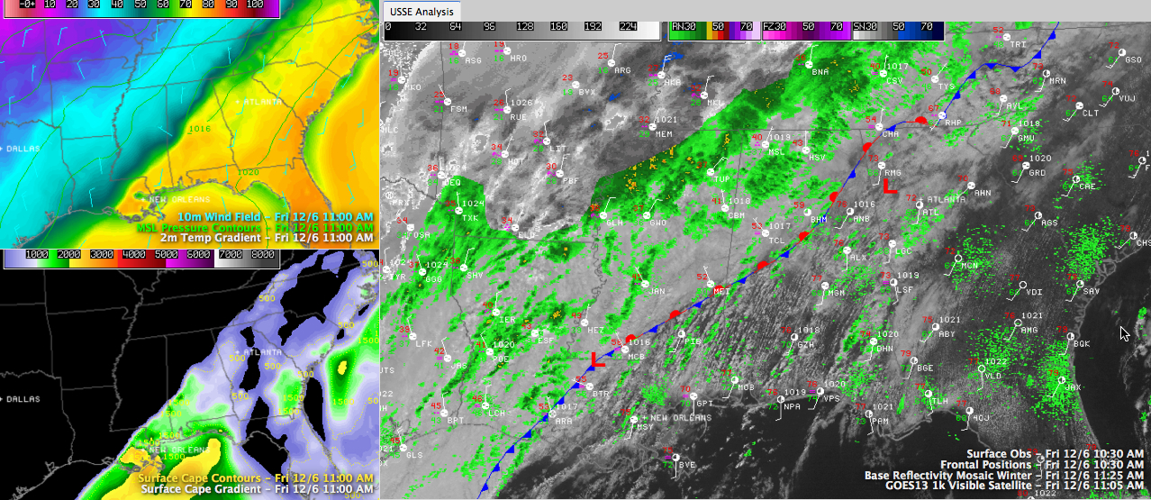
It is a tale of two airmasses across Central Alabama at this hour.
Our frontal system is basically stationary in the I-59 corridor.
Click to enlarge
It is 61F at the Birmingham Airport and 76F at Calera. 77F at Anniston, and 52F at Tuscaloosa. 78F at Alex City and 46F at Jasper.
It is 37F at Haleyville and 32F at Olive Branch MS, on US-78 just south of Memphis. It is 32F at Oxford as well.
Light showers are over parts of Cullman, Winston, Marion, Lamar and Fayette Counties.
Along and ahead of the front, heavier showers were occurring from Sumter and Greene Counties up into Bibb, Shelby and southern Jefferson Counties over to the Pell City and Anniston areas.
The airmass is becoming marginally unstable ahead of the front in the warm sector. Bu the strong wind shear is behind the frnot. Some of the showers ahead of the front will grow into storms over the next few hours. Can’t rule out one or two of them becoming strong, and there is a small chance of a storm becoming severe, but the chance is very, very small.
SIGNIFICANT WINTER STORM TO OUR NORTH, NORTHWEST AND WEST
A wintry mix is occurring this morning from southern Ohio through Indiana and Southern Illinois, much of western Kentucky, southeastern Missouri, much of Arkansas, western Tennessee and northwestern Mississippi.
North of a line from Little Rock to Louisville to Columbus it is mostly snow. South of it, up to 0.1 inches of freezing rain per hour is possible.
Roads are very hazardous over parts of Arkansas. Some decent snowfall accumulations have been reported over southern Missouri.
Ice was starting to accumulate at the Memphis Airport as of 10:30. Roads are becoming slick in parts of western Tennessee.
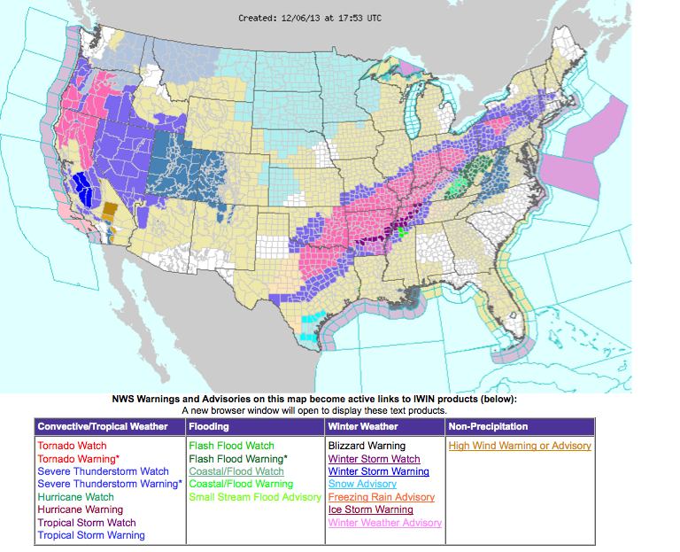
Ice storm and winter storm warnings are in effect for areas to the west and northwest of Alabama. If you are traveling to the west or northwest, check local weather conditions.
Here are the latest NWS advisories on a national map: