


Daily Weather Briefing
Sunday, June 14, 2026

ALABAMA MORNING
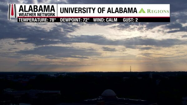
This morning is humid with a few spotty showers spreading across north Alabama. Priceville, Hartselle, Cullman, Nauvoo, Ashridge, and south of Cherokee see showers. The rest of north and some of central Alabama see mostly cloudy skies, but cloud cover dissipates some toward the south. Temperatures are already reading in the low to upper 70s statewide, and dewpoints make the air feel heavy at the low to mid 70s. Our Regions Skycams captured gorgeous views of the sunrise this morning!
ALABAMA 7 DAY FORECAST
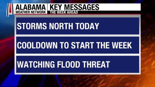
Widespread rain and thunderstorms are expected in north Alabama as a cold front will move through the area this afternoon and evening. Central and south Alabama will see the same scattered afternoon pattern we’ve seen recently. The front will move southward slowly on Monday and Tuesday, bringing more widespread rain and storms to the state, focusing more on the central and southern portions of the state. The upper-level pattern will become zonal (horizontal) toward the latter half of the week, but expected short waves will pass through the northern half of the state, keeping rain chances elevated. The southern half of the state will return to a less broad rain pattern.
WET NORTH, SCATTERED SHOWERS SOUTH TODAY
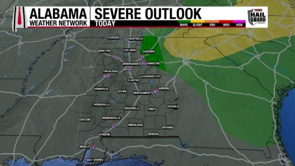
Before the cold front enters the state today, north Alabama will see partly to mostly cloudy skies, allowing sunshine to reach the region and temperatures to reach the upper 80s and lower 90s. Then, showers and thunderstorms in front of/associated with the cold front will push through in the afternoon. These storms will interact with our hot air, and storms o become strong, and even severe. The severe potential is highest in northeast Alabama where a Marginal Risk (1/5) of Severe Thunderstorms has been placed by the Weather Prediction Center. Damaging winds and low hail possibility are the main concerns with any severe storms. Heavy rains are the concern for the entire region, as the soil is already 1. very saturated from last week’s floods, and 2. there is ample moisture available in the air. Heavy downpours are expected which is a recipe for fallen trees, downed power lines, and flooding when combined with wet soil and strong winds. We’ll be watching the weather here at the Alabama Weather Network and will go live for any flooding or severe threats that arise today.
Central and south Alabama will see partly cloudy skies similar to yesterday, and scattered afternoon showers and thunderstorms. Highs will reach the low 90s centrally and the low to mid 90s south. We’ll see an uptick in rain chances this evening as rains from the front enter central and eventually south Alabama, although they will be much less widespread.
MOSTLY DRY TONIGHT
Showers will taper off tonight, with just a few showers lingering in the south. It’ll be humid, with lows falling to the mid 60s north, low 70s centrally, and the mid 70s south, and dewpoints reaching a similar spread.
WIDESPREAD SHOWER PATTERN TO BEGIN THE WORK WEEK
The cold front from today will stall over central Alabama by Monday morning as it joins forces with a low-pressure system to our west. This will be responsible for our broad shower and thunderstorm pattern we’re expecting over central and south Alabama Monday and Tuesday. Moisture availability will still be quite high in the region, and heavy downpours and flash flooding is anticipated both days. Rain chances do not go to zero in north Alabama either day, but they will be much lower compared to today. Temperatures will begin to see the effects of the cold front by Monday, with highs only hitting the upper 70s and lower 80s through north and central Alabama. They will still manage to rise to the upper 80s and lower 90s south. The cooler highs spread across all of Alabama Tuesday, with the upper 70s and lower 80s stretching over the state. The coast is the exception as the front stall again in the region and highs are able to climb to the upper 80s and to 90 degrees.
STILL RAINY MIDWEEK
Showers and thunderstorms will continue to span over the state Wednesday, but the pattern should be more scattered in the northern half of the state. The front sticks stubbornly around south Alabama Wednesday, and yet another day of wide-ranging showers is in store for the southern half of the state. Highs will already be rebounding into the low to mid 80s over Alabama.
RAIN CHANCES INCREASING NORTH, DECREASING SOUTH
As we head into the end of the week, we’ll see rain chances begin to increase in the northern half of the state and decrease toward the southern half. As mentioned above, the upper-level pattern will flatten out some, bringing the ability for showers to occur in the south down. Despite the less supportive environment for showers, short waves will push through the northern half of Alabama, encouraging rain to continue in the region. Widespread rain chances are 70% Thursday and 80% Friday in the northern half, with highs reaching the upper 80s. Less widespread, but not low rain chances of 50% are expected both days in the southern half; highs topping out in the mid 80s in north Alabama and the upper 80s and lower 90s in the south.
SLIGHTLY LESS RAIN SATURDAY
Rain chances fall to 40% on Saturday statewide, so hopefully some locations will see a drier day. The mid to upper 80s span from north to south in the state with the coast attempting to hold onto the 90s.


RAINFALL OUTLOOK
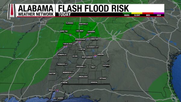
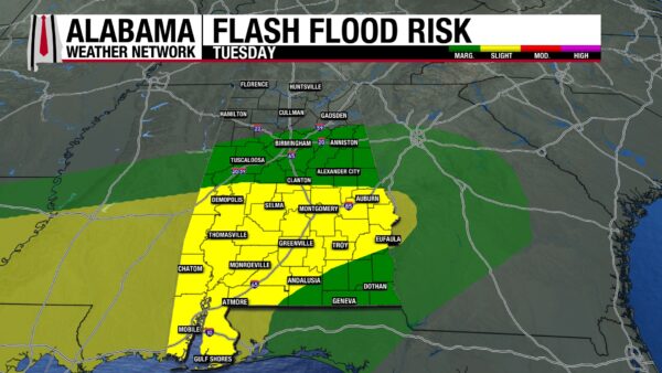
The predicted rainfall amounts across the state have jumped quite a bit since yesterday, with 2 to 6” possible across Alabama. The pockets of the highest amounts are across south-central Alabama, especially in the western portion. These high amounts of rain are due to the very wet pattern we are about to enter. Today, a Marginal Risk (1/4) for Excessive Rainfall spreads across northern Alabama. As the rain chance shifts south Monday, so does the flash flood risk and we’re watching a Slight (2/4) flash flood risk across much of south Alabama. A Marginal Risk spreads over the coast, southeast Alabama, and north central Alabama. A similar flash flood risk is expected Tuesday.

Flash floods really are quite the concern as highlighted earlier in today’s forecast section. Alabama has seen quite a bit of rain over the past 30 days or so, with locations seeing almost or more than 2 to 3 times their normal rainfall amounts that they usually get in the past 30 days. (These areas are where the percentage is 200-300). Southeast Alabama could stand to get some more rain, but southwest and northeast are very saturated. So, over the next seven days, these very wet areas will struggle with the rain we’ll see this week.
THE LOW PRESSURE SURVIVES STILL
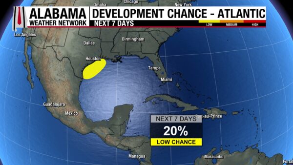
The low-pressure system we’ve had our eye on in the Gulf over the past few days continues to stay organized enough to hold onto a 20% chance of development over the next seven days. It sits over northeast Mexico now but is expected to move back over the Gulf later this week and interact with the front that will move through Alabama early this week.
ANOTHER NICE BEACH DAY
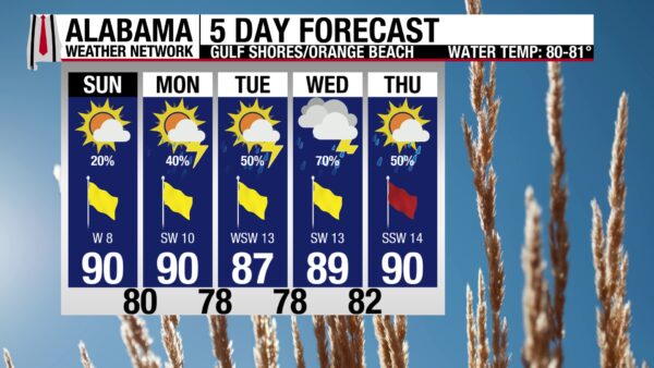
Today will be another pleasant day to get outside and enjoy the beach. The high will be around 90 degrees, with winds from the west from 5 to 10 mph, and mostly sunny skies. There is a 20% chance of rain in the area, but showers should pop-up quickly in the afternoon/evening and do little to ruin anyone’s day. The water isn’t so nice with a Moderate rip current risk and a 2-foot surf height. Rain chances increase from Monday onwards, with the rip current risk staying elevated throughout the week as well. Make sure you get outside and enjoy the weather today.

WEATHERBRAINS 1065
The WeatherBrains episode from Thursday will be released on listening platforms and the WeatherBrains website Tuesday morning!
TODAY IN WEATHER HISTORY
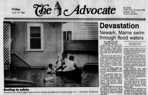
June 14, 1990 – The Shadyside Flash Flood
On the morning of June 14, 1990, the weather charts across the Ohio Valley did not clearly signal the disaster that would unfold that evening near Shadyside, Ohio. The spring had been wet, and soil moisture levels were already high. A stationary front lay across the Midwest, deep low-level moisture covered Ohio, and an outflow boundary from thunderstorms the night before moved across Indiana. That boundary became the focusing mechanism for slow-moving thunderstorms over the steep terrain near Shadyside.
By evening, the storms unloaded three to four inches of rain in about 75 minutes on already saturated ground. The runoff was immediate, racing into the narrow valleys of Wegee Creek, Pipe Creek, and Cumberland Run. Water surged through the canyons in a 15-to-20-foot wall, carrying mud, trees, vehicles, buildings, and bridge debris downstream. Homes were swept away, roads vanished, and people had little time to react before the flood struck.
Twenty-six people died in the Shadyside flash flood, and some bodies were found as far as 30 miles downstream. It became the deadliest and most destructive flash flood in the United States in at least a decade, often compared in severity to the Big Thompson Canyon flood of 1976. The tragedy showed how a seemingly ordinary summer setup can turn catastrophic when slow storms, saturated ground, and steep terrain focus too much water into one small place too quickly.
IMAGE(S) OF THE DAY
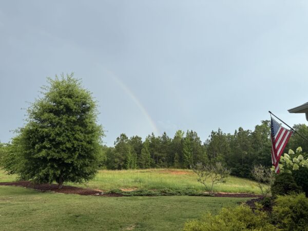
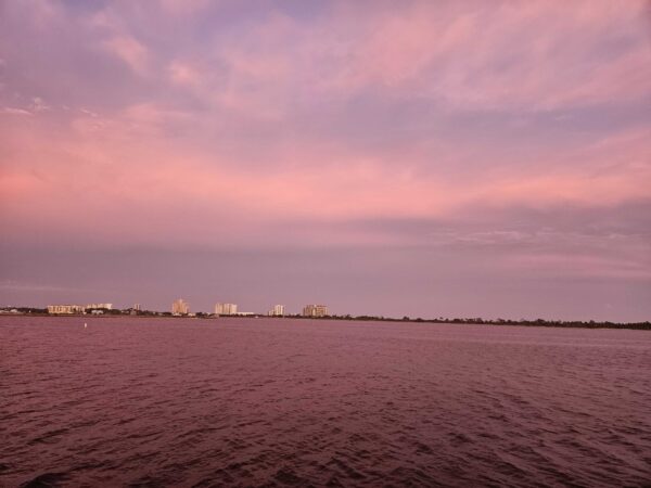
Our Skywatchers sent in some wonderful photos from yesterday evening so it was hard for me to choose just one!
1. Vanessa Sanchez – Rainbow in Duncanville
2. Duncan Hope – Sunset at Orange Beach



