


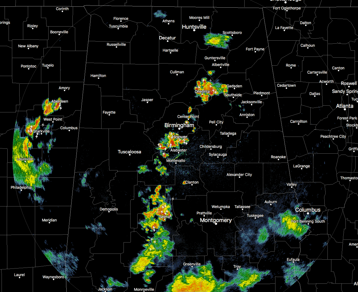
Radar is pretty active at 8:10 PM on this Saturday evening. We have a strong storm over the southern parts of Jefferson and the northern parts of Shelby County that has caused some damage. We have reports through media that some trees and power lines have been downed in Bessemer.
Along with that, an Areal Flood Advisory has been issued for west-central Shelby and southwestern Jefferson counties until 10:00 PM. The possibility of 1.00-2.00 inches could fall in a short period of time leading to minor flooding in the advisory locations. These possible locations are outhwestern Birmingham, Hoover, Vestavia Hills, Bessemer, Homewood, Pelham, Helena, Hueytown, Fairfield, Midfield, Brighton, Indian Springs Village, Lipscomb, North Johns, Bluff Park, Splash Adventure, Riverchase, Patton Creek, Hoover Metropolitan Stadium and Ross Bridge.
Several Significant Weather Advisories have been issued throughout the area due to strong storms that have gusty winds, dangerous lightning, and heavy downpours. Portions of Bibb and Shelby counties is the only part of the area under one at this point, as the storm from Jefferson County moves into those counties. Strong gusty winds of 35 MPH is possible with this cluster of storms as it moves to the southeast at 15 MPH.
All other storms have dropped below advisory level at this point, but the larger storms to keep an eye on are located over portions of Blount, Etowah, Calhoun, and St. Clair counties, and down over portions of Perry and Dallas counties.
These storms should start weakening within the next hour or so as we continue to lose the daytime heating, and is expected to dissipate by just before midnight.



