


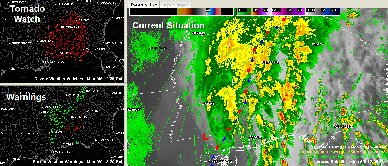
Heavy rain with a few embedded tornadoes continues across Alabama this Labor Day afternoon. You can see the watches and warnings on the left side of the panel above.
The weather map shows a stationary front over North and western Alabama. It is slowly pushing east, propelled by a deep upper level trough that is going to put an end to our summer of hot weather.
The remnant low of Lee is just northwest of Mobile, also pushing east.
The heavy rain will continue to push east this afternoon, with a threat of isolated spin up tornadoes east of the front. A tornado watch is in effect until 7 p.m. A flash flood watch remains in effect until tomorrow morning.
A Few Notes…
Skywatcher Judy Freeman passed on a report of a partial ceiling collapse in a business on 280 – Inverness area. Inside of store flooded. No details yet.
John Talbot reports a deputy has run off the road into a ditch by the Saw Mill Restaurant off highway 5 near Brent.
NWS reports…4 Sw Wateroak [Hale Co, AL] emergency mngr reports TSTM WND DMG at 11:05 AM CDT — possible tornado reported near intersection of highway 25 and county road 85. trees reported down and roof was off a barn.
Judy reports 1.88 inches of rain in Center Point. Greg reports 2.43″ in Meadow Brook. 4.9 inches at Snead in Blount County according to Scott. Ron Hughes reported 5 inches in Coker as of 12:16.



