


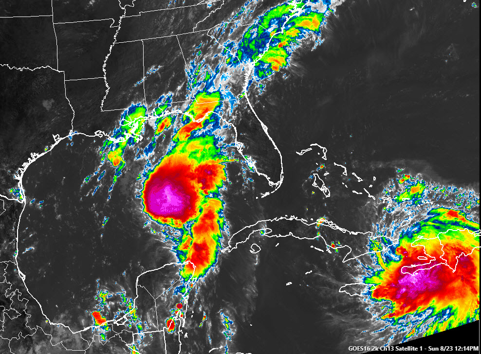
This dramatic satellite image shows our two tropical cyclones, Marco getting stronger over the Central Gulf of Mexico and a large Laura moving over the Windward Passage between Cuba and Hispaniola.
Alabama is bisected by an old front that lies somewhere in the I-59 Corridor early this afternoon. The convergence zone associated with that old front triggered a few persistent showers this morning that brought rains to parts of Northeast Alabama. Some high clouds are evident in the I-59 corridor, along with leftover low clouds from this morning’s activity.
A few showers are starting to pop up over Northeast Alabama.
Temperatures have had a hard time getting to 80 degrees where it has been cloudier this morning, but readings were in the lower and middle 80s over North as well as South Central Alabama.
Scattered showers and storms will develop this afternoon with the heating of the day and we will be monitoring the huge shield of moisture in the Gulf associated with Tropical Storm Marco.
Showers and storms are already plentiful all along the coast from southeastern Louisiana through coastal Mississippi, Alabama and Northwest Florida. Showers and storms associated with the outer fringes of Marco will spread up into southern and Central Alabama overnight and Monday.
Parts of South Central Alabama could see one half-inch of rain by Monday night with a quarter-inch of North Central sections.
Highs today will be in the middle and upper 80s with a smattering of 90-degree readings. Lows tonight will be in the lower 70s mostly. Highs on Monday will generally be in the middle 80s.



