


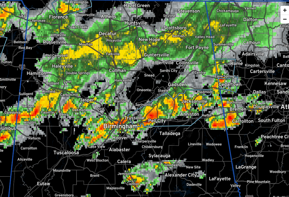
No severe thunderstorm warnings across Alabama at this hour.
A line of storms extends almost wall to wall from southern Lamar County through Central Fayette County near the town of Fayette, then becoming more broken over northeast Tuscaloosa and western Jefferson County, to near Downtown Birmingham, through northern St. Clair County to near Ragland, Jacksonville, and then across eastern Cherokee County down through Cleburne County.
The strongest storms now are the ones from eastern Jefferson County through St. Clair into Calhoun Counties.
These storms are actually getting stronger as they slowly sag southward while move eastward individually.
South of these storms, a few isolated storms are near Marion in Perry County and near Clanton in Chilton County.
The airmass over North Alabama has been fairly well worked over by earlier convection and there is just a large rain mass from Haleyville through Decatur, Falkville, Scottsboro and Sylvania.
In Mississippi, scattered heavy thunderstorm continue. Some of them will work into Alabama later this evening. There is a severe thunderstorm between Vicksburg and Jackson.
Be alert to changing weather conditions around you if you are outdoors and listen for any severe thunderstorm warnings that might be issued.



