


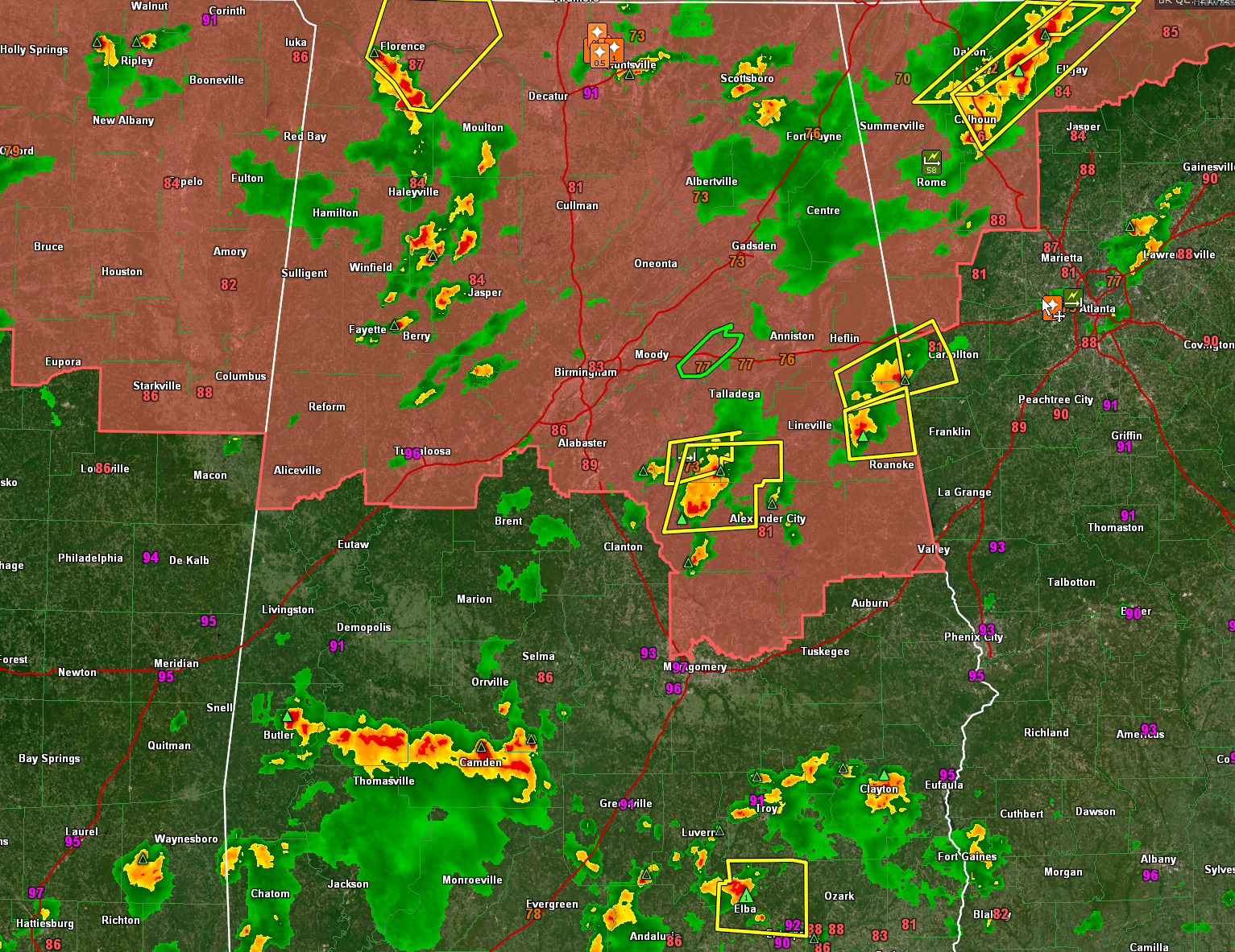
It has been a busy afternoon with lots of warnings…here are some notes at 4:45…
Sector 1 (North and west of I-59/20 & I-65): Severe thunderstorm warning just issued for Lauderdale, Lawrence, Colbert, and Limestone Counties for strong storms are approaching the Shoals. Winds gusted to 40 mph at the Florence Harbor Marina. Clusters of multicellular storms cover parts of Marion, Winston, Fayette, Walker, and northern Tuscaloosa.
Sector 2 (North of I-20 and east of I-65) storms are severe in the Huntsville area. A severe thunderstorm warning remains in effect for a stationary storm near Huntsville. Another strong storm is approaching Scottsboro but is not severe at this time.
Sector 3 (south of I-20, north of I-85 and east of I-65) storms are severe over southern Talladega, Clay, and northern Coosa Counties. Biggest core is southwest of Stewartville with another near Overbrook. Movement is east. Other severe storms are over extreme southeast Cleburne and Randolph Counties. Folks in Wedowee are going to see some hail. Damaging winds are possible are well. The other strong storm is passing south of Ranburne.
Sector 4 (south of I-85) strong storms are over Barbour, Bullock, and Pike Counties. The strongest storms are from northeast of Troy to near Clayton. A severe storm north of Elba has promoted a severe thunderstorm warning for Coffee County. There is some decent hail in that storm.
Sector 5 (Southwest Alabama west of I-85 and south of I-59/20): Strong storms are over Choctaw, Marengo, Dallas, and Wilcox Counties. The strongest storm is near Camden. The storm southwest of Pennington may have hail in it.



