


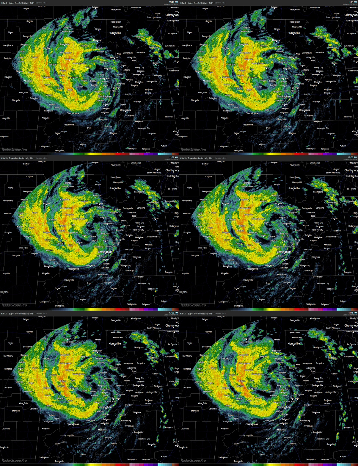
At 12:15 PM, the heaviest rain associated with Alberto is in a band wrapping around from Moulton to Haleyville to Winfield to Sylvan Springs. Much of the rain activity is located to the northwest and west of the center of circulation, which is currently around the Arley community in Winston County. Rainfall rates with these bands have been estimated by radar at right over 1.00″ per hour.
Movement is still just to the west of due north at 12 MPH, but the forward speed is expected to start accelerating this afternoon. Maximum sustained winds are estimated at around 30 MPH.
If the daytime heating climbs high enough to start convective development (which needs to hit 75 degrees to do that), with the help of any sun breaking through Alberto’s cloud deck, we could have more shower and storm development on the eastern and southeastern side of the center. But it looks at this point that the possibility of any brief spin-up tornadoes is very, very low. Gusty winds and heavy rainfall will continue to be the main threats closest to the center and to the west.
South of a line stretching from Tuscaloosa to Sylacauga to Roanoke, conditions are starting to quickly improve as the main rain bands associated with Subtropical Depression Alberto has now moved north of that line. Still may be a little breezy at times but you’ll have a good chance to dry out for a little while.
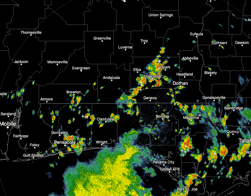
Down in South Alabama and across the Florida panhandle, showers and thunderstorms have begun to develop with the heating of the day and they are feeding off of the left over moisture from Alberto. These are moving to the northeast at a decent speed and will affect the southeastern counties of Central Alabama over the next hour or so.
NWS Birmingham is considering removing the southernmost counties from the Flash Flood Watch that goes until 7:00 PM tonight, but with these showers and storms developing, they may hold on for a few more hours before dropping counties. That watch is for Autauga, Barbour, Bibb, Blount, Bullock, Calhoun, Chambers, Cherokee, Chilton, Clay, Cleburne, Coosa, Dallas, Elmore, Etowah, Fayette, Jefferson, Lee, Lowndes, Macon, Marion, Montgomery, Perry, Pike, Randolph, Russell, Shelby, St. Clair, Talladega, Tallapoosa, Tuscaloosa, Walker, and Winston counties.
A Wind Advisory continues until 2:00 PM this afternoon for Autauga, Barbour, Blount, Bullock, Calhoun, Chambers, Cherokee, Chilton, Clay, Cleburne, Coosa, Dallas, Elmore, Etowah, Jefferson, Lee, Lowndes, Macon, Montgomery, Pike, Randolph, Russell, Shelby, St. Clair, Talladega, and Tallapoosa counties.
There have been numerous reports of fallen tress and power lines along with flooded streets all across the area, especially on the western side of the area. Be very careful as you venture out today. Take it a little slower out there on the roadways and remember to not drive on flooded streets at all. Turn around, don’t drown!
On This Day In Weather History
1953 – A tornado, 600 yards wide at times, killed two persons on its 20 mile path from southwest of Fort Rice ND into Emmons County. Nearly every building in Fort Rice was damaged. The Catholic church was leveled, with some pews jammed four feet into the ground.
Beach Forecast Center
Get the latest weather and rip current forecasts for the beaches from Fort Morgan to Panama City on our Beach Forecast Center page. There, you can select the forecast of the region that you are interested in.
WeatherBrains
Don’t forget you can listen to our weekly 90 minute netcast anytime on the web at WeatherBrains.com or on iTunes. This is the show all about weather featuring many familiar voices, including the meteorologists at ABC 33/40.
E-Forecast
Get the AlabamaWx Weather Blog’s Seven-Day Forecast delivered directly to your inbox by email twice daily. It is the most detailed weather forecast available in Central Alabama. Subscribe here… It’s free!
Advertise With Us
Don’t miss out! We have enjoyed over 10 MILLION page views on AlabamaWx.com since the start of 2018. We can customize a creative, flexible and affordable package that will suit your organization’s needs. Contact Bill Murray at (205) 687-0782.



