


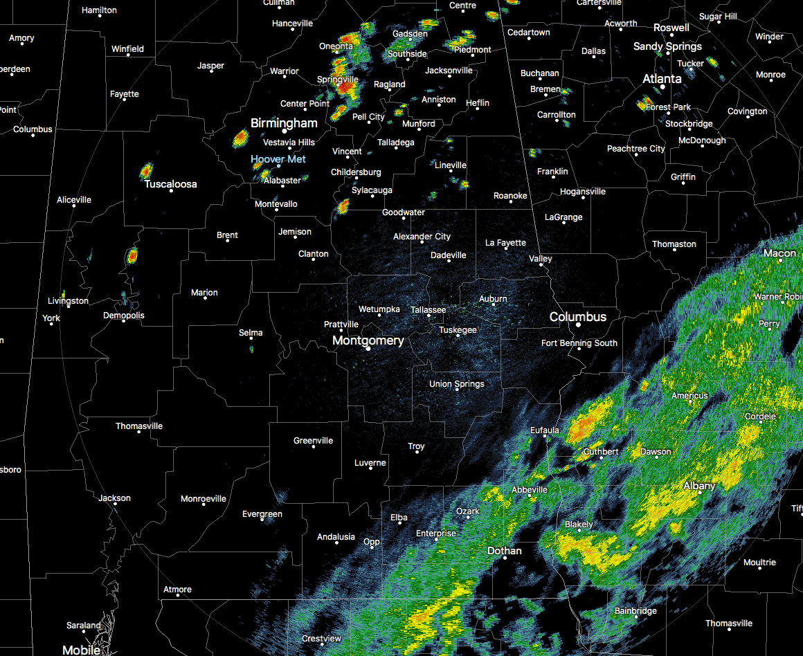
Radar Check On Alberto at 3:25 PM
The first band of rain associated with Subtropical Storm Alberto is now entering the southeastern parts of Central Alabama as the associated showers are moving westward out of southwestern Georgia. Nothing is particularly heavy at this point, just light to moderate tropical showers. The showers and storms that you see in the northern parts of the area are the typical afternoon scattered storms we have been seeing for the past 10 days.
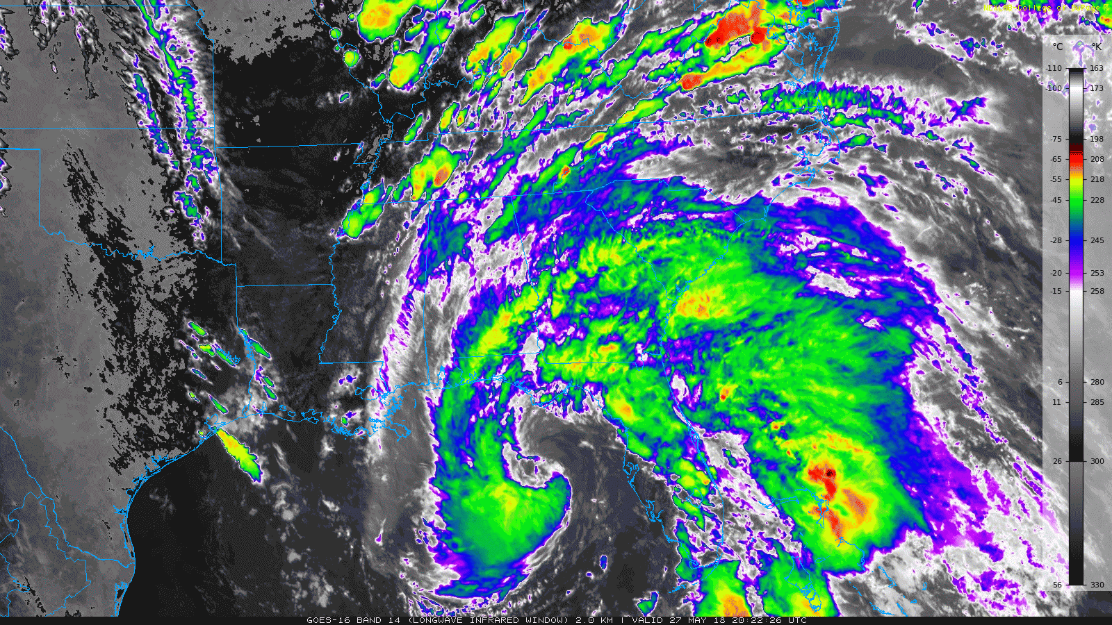
While the motion of the rain is rotating to the west at the moment, the general motion will continue northward throughout the remainder of the afternoon and into the evening. The latest forecast path continue to have the center of Alberto making a northwestward turn sometime tonight and the current forecast landfall is expected to take place at or near Panama City Beach on Monday morning as a strong tropical storm. Forecast maximum sustained winds will be around 60 MPH with gusts up to 70 MPH possible.
The forecast track continues the movement just north of northwest through the day on Monday, and the center is forecast to be located around Luverne at 8:00 PM Monday night. By that time, movement is expected to become more northward and will make its way towards Birmingham, where it is expected to be close by at 8:00 AM Tuesday morning. Maximum sustained winds at that time should be around 30 MPH with gusts up to 40 MPH possible.
After that, movement will really start to accelerate to the north and the remnant low of Alberto should be out of the state by late afternoon to the early evening hours on Tuesday. By Wednesday morning, what is left of Alberto will be picked up by the westerlies and quickly ushered off to the northwest.
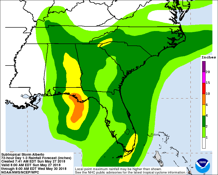
Impacts On Central Alabama
FLOODING: The main threat from Alberto to Central Alabama will be from very heavy rainfall and the possibility of flash flooding. Rainfall totals along and east of I-65 could be as high as 4.00″-6.00″, while tapering down to 1.00″-3.00″ west of that. Flash flood watches are already in effect for south Alabama and could be issued for the eastern parts of the area later today.
WIND: Strongest winds associated with Alberto should be around 20-30 MPH with gusts up to 40 MPH possible closest to the circulation center. A few trees will fall and a few scattered power outages are possible, but fortunately these winds should not cause serious damage or major power outages.
TORNADOES: A few spin-up tornadoes are possible on the east and northeastern sides of the storm as it moves through Central Alabama. With the current forecast track, the main threat for these will be east of a line from Montgomery to Leeds to Blountsville.
Weather For The Remainder Of The Week After Alberto Leaves
The remnants of Alberto will be speeding off to the northeast after it is picked up by the westerlies on Wednesday, unfortunately leaving very moist air in place over Central Alabama. This means we will return to the same weather pattern that we’ve seen over the past 7-10 days in the area… very warm and humid with some sun at times, and the daily risk of scattered afternoon and early evening showers and thunderstorms. Highs will be back up in the upper 80s to the lower 90s.



