


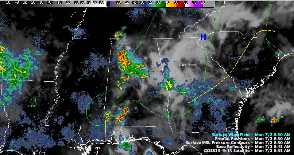
It has been an interesting morning across North Central Alabama.
A large outflow boundary pushed into Alabama from the east overnight from evening storms that had affected Georgia.
A little bubble of high pressure developed behind that outflow and pushed the quasi-cool front of the outflow westward triggering showers and storms. The upper flow is still from the west northwest, so the storms have been pushing slowly east southeast.
Fairly thick clouds cover much of Central Alabama north of a line from Vernon to Fayette to Calera to Columbiana to Dadeville to Opelika. North of this line, clouds and rain will last much of the morning and keep temperatures down.
South of the line, hazy sunshine will still permit temperatures ti get quite hot today.
The NWS has canceled the heat advisory for Blount, Calhoun, Chambers, Cherokee, Clay, Cleburne, Coosa, Etowah, Fayette, Jefferson, Lamar, Lee, Marion, Randolph, Shelby, St. Clair, Talladega, Tallapoosa, Walker and Winston Counties, where the clouds and rain will keep heat index values below 105F today.
It continues for Autauga, Barbour, Bibb, Bullock, Chilton, Dallas, Elmore, Greene, Hale, Lowndes, Macon, Marengo, Montgomery, Perry, Pickens, Pike, Russell, Sumter and Tuscaloosa Counties, where highs will still reach 95F-100F and heat indices will rise to 105F-110F.
The difference in the rain cooled air to the north and the increasingly hot air to the south will provide a focus for showers and storms later today. Some of them could be heavy, with the potential to produce damaging wind gusts. Nothing as widespread as yesterday, but they could be strong to severe later.
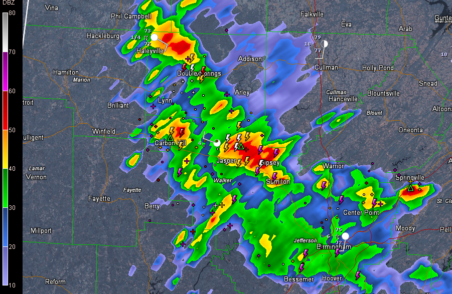
Just before 9 a.m., the heaviest rain and storms were over eastern Marion, Winston and Walker Counties. A strong storm indicating small hail was north of Jasper in the Manchester community. Others were north of Haleyville extending down to Double Springs. A decent storm was near Carbon Hill.
Light to moderate rain and near continuous thunder covered much of the Birmingham Metro.
To the northeast, a decent storm was near Springville.



