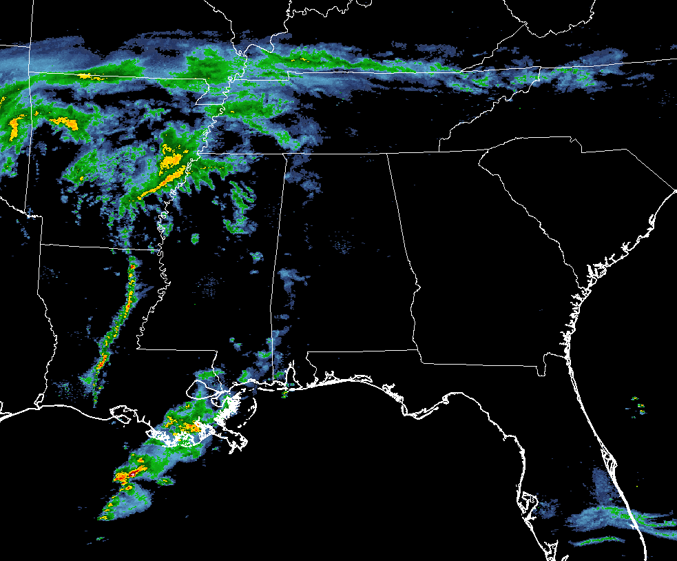
At this time across Central Alabama, some light rain has pushed into the western parts of the area. A warm front has started to make its way northward across Central Alabama, and dewpoints are only in the low to mid 40s south of the front. Moisture levels will continue to increase as the surface low makes its way along the I-20 corridor. Good news for Central Alabama is that the more unstable and moisture-rich airmass will stay to our south, and any storms that do form will be below severe limits.
The rain mass that is located over the southern parts of Mississippi and eastern Louisiana has actually shrank in size over the past hour or so, and that will affect the extreme southern portions of the state and the Gulf Coast. Another broken line of storms is located over central parts of Louisiana and eastern Arkansas. These are continuing to push off to the east, and should be entering the state near midnight.
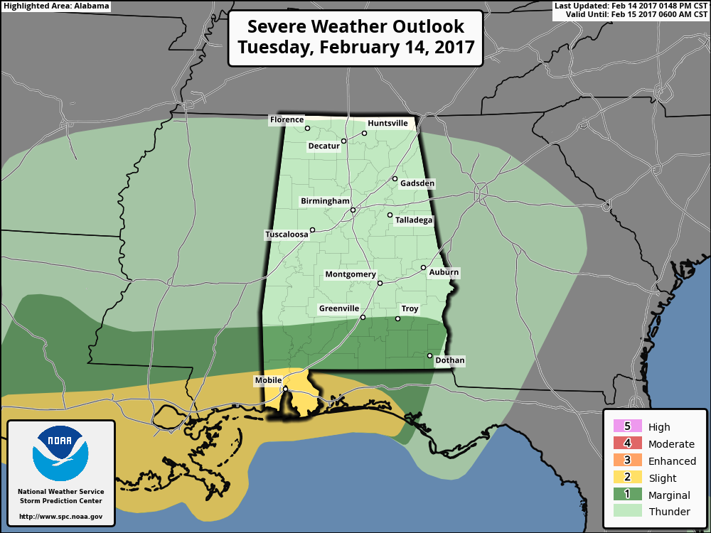
There are no current warnings in effect for anyone in the southeast at this point. SPC is continuing with their thinking of the stronger storms being confined to our south, as the latest update on the Severe Weather Outlook still shows much of Mobile and Baldwin counties as the only places in Alabama in a slight risk for severe storms, with locations south of Greenville and Troy in a marginal risk. Main risks will be from gusty thunderstorm winds and hail, with an isolated tornado or two possible.
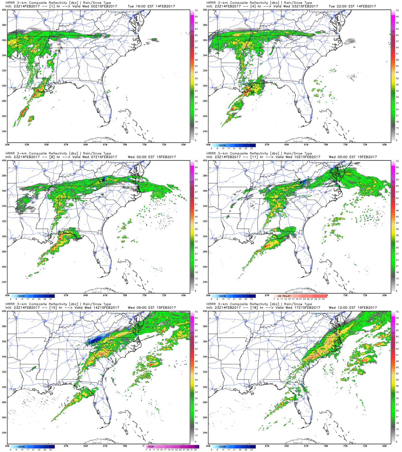
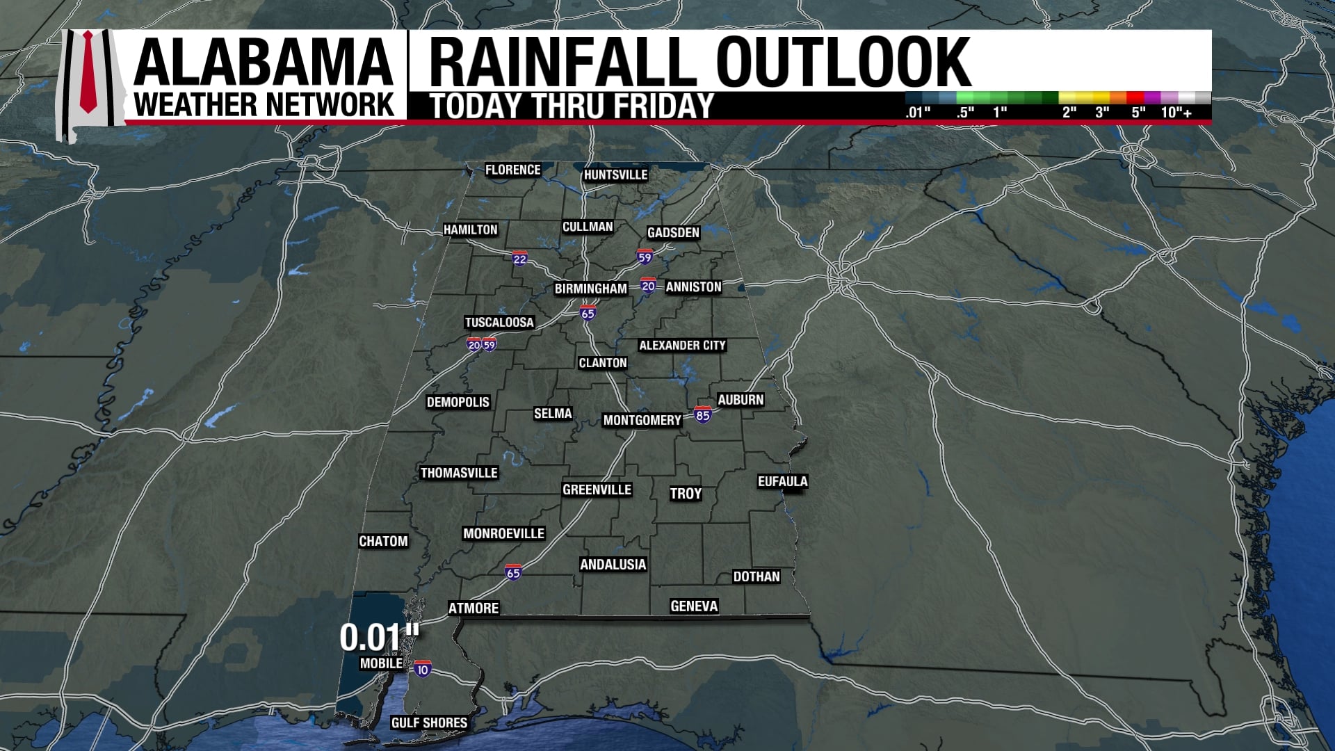
All of this action will be out of here by 9:00 AM tomorrow morning, and the day will feature decreasing clouds and breezy. Afternoon highs tomorrow will be in the low to mid 50s for the north and central parts of the area, with mid 50s to the mid 60s to the south. Winds will be averaging 10-20 MPH out of the northwest, and will make those high temperatures feel much cooler. Rain totals for the event should be around 1/4 to 1/2 inch, with some locations receiving over 1/2 inch.