Daily Weather Briefing: August 9, 2026
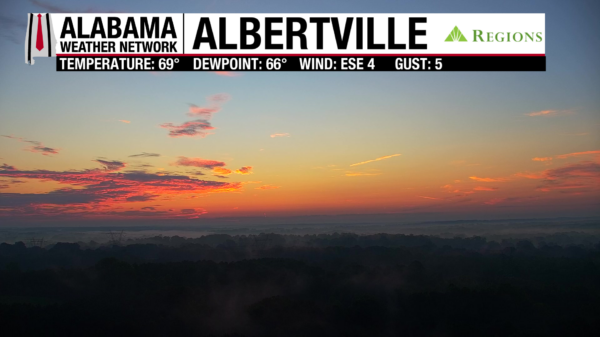
SAME SUMMER PATTERN CONTINUES: Happy Sunday!! Alabama is heading into another week that looks very familiar for August: humidity, scattered afternoon to evening showers and thunderstorms, and heat indices creeping toward the triple digits. Some neighborhoods will get soaked while others nearby may stay completely dry. That’s just how August works around here! There are no major pattern changes expected across Alabama, but there are a couple of areas in the tropical Atlantic worth watching this week.
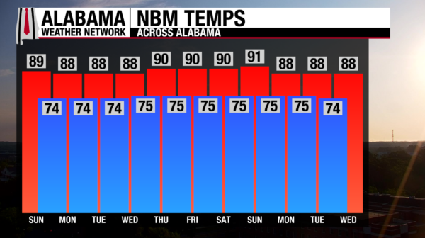
FEELS-LIKE TEMPERATURES: The temperature alone isn’t expected to change much through the middle of the week, but the humidity will remain high. That means it will feel considerably hotter than the actual air temperature. Heat indices will generally reach into the upper 90s. For now, temperatures are expected to remain below heat advisory criteria. By Friday into next weekend, there is some potential for an upper-level ridge to strengthen across the Southeast, which could push temperatures and heat indices higher.
RAIN CHANCES: The overall pattern stays locked in through much of the week. The best opportunity for rain will come during the afternoon and evening when daytime heating and abundant moisture help fuel convection, allowing for pop-up showers to form. Slow-moving storms could produce locally heavy rainfall, but widespread rain isn’t expected. Your exact location could make all the difference on any given afternoon.
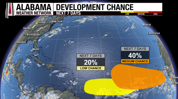
TROPICAL UPDATE: There are two areas of interest in the Atlantic this morning.
The first is a broad area of disturbed weather associated with a tropical wave several hundred miles southwest of the Cabo Verde Islands. Some gradual development is possible during the early to middle part of next week as it moves westward across the central tropical Atlantic. Its chance of development over the next seven days is very low (20%). Conditions are expected to become less favorable later in the week as it approaches the Lesser Antilles.
The second tropical wave is expected to move off the west coast of Africa early this week. Conditions could become favorable for gradual development, and a tropical depression could form during the latter half of the week as the system moves westward across the eastern and central tropical Atlantic. Its chance of development over the next seven days is at a medium chance (40%).
GULF IS WORRY-FREE RIGHT NOW: The important takeaway for Alabama to remember is that tropical storm development is not expected in the Gulf for at least the next seven days. These two areas we’re watching are well out in the Atlantic. For now, these are simply areas to monitor, with no threat to Alabama.