


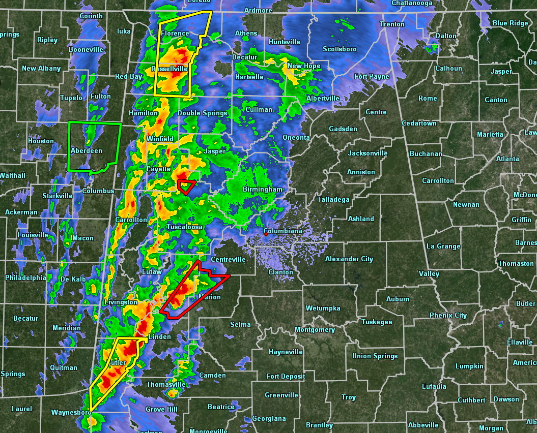
A broken line of storms including supercells continue to move across the western parts of North/Central Alabama as we have reached 1:40 am with a tornado warning currently in effect for Hale and Perry counties until 2:15 am. There is a severe thunderstorm warning in effect for parts of Colbert, Franklin, and Lauderdale counties until 2:00 am.
The latest SPC Mesoscale Analysis shows that instability values are still ranging from 500 J/kg to 1,500 J/kg across North/Central Alabama at this time. Bulk shear values are still high at 60-75 kts. Helicity values from the surface to 3km are ranging from 250-650 m2/s2. All of these factors continue to point toward severe storm development with the ability of storms to continue for a good bit of time. STP values are ranging from 2.0-5.0 across the portions of the area where the storms are currently occurring and just ahead of the line of storms.
All of this means that our threat for severe storms will continue for a while through the early morning hours on Sunday. The central and eastern parts of North/Central Alabama need to be ready when these storms move in within the next couple of hours.
Back to our west, we now have at least 2 confirmed fatalities in Hamilton, Mississippi, along with multiple structures destroyed with entrapments. These storms have not weakened that much since moving into Alabama, so we do not need to let our guard down at all.
We’ll continue to keep you posted throughout the event.



