


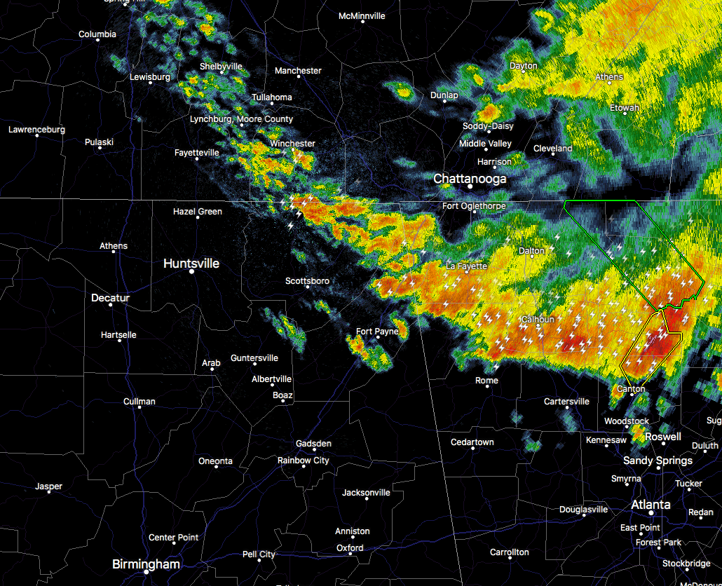
We have the western edge of a MCS moving through the extreme northeastern parts of North Alabama as we make the run up to the 5 o’clock hour on your Saturday morning. We have a good bit of cloud-to-ground lightning and heavy downpours occurring over the eastern parts of Jackson and Dekalb counties. Winds up to 50 MPH is possible with this cluster of storms as it moves to the southwest at 10 MPH. Heads up if you are in the path of this batch of storms as those gusty winds will be capable of knocking down small tree limbs and blowing small unsecured items around. Those in the path include Scottsboro, Fort Payne, Fayetteville, Rainsville, Hazel Green, Henagar, Sylvania, Hollywood, Powell, and Huntland.
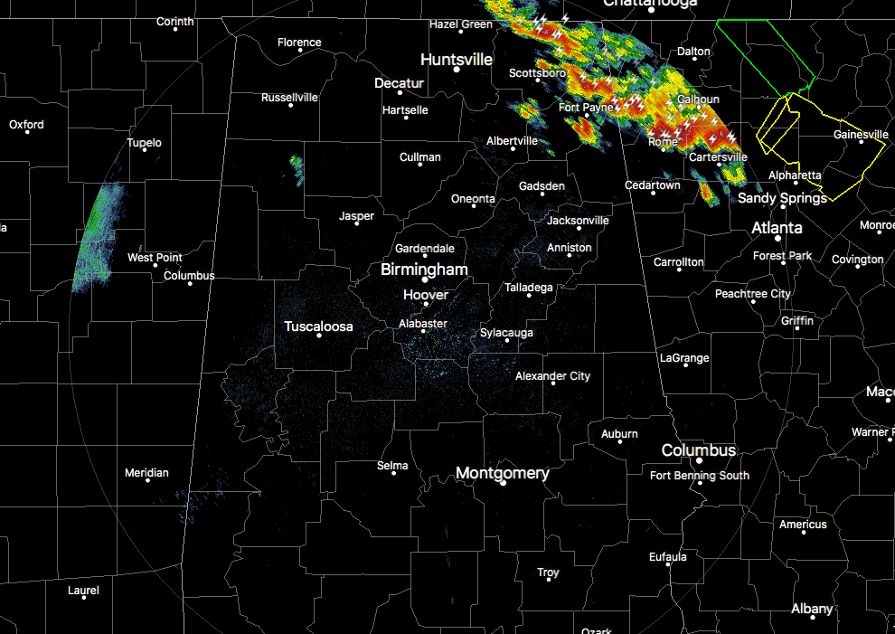
For the rest of North and Central Alabama, all remains relatively quiet at this point. Only a small shower has developed over the eastern parts of Marion County, and that is it as far as rainfall. We still have an unstable atmosphere out there with instability values still topping out in the 2500-3500 J/kg range.
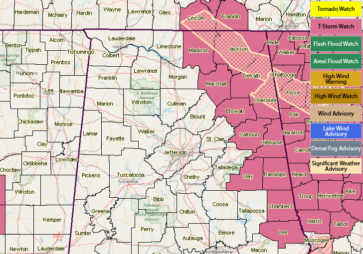
A Severe Thunderstorm Watch continues for Calhoun, Chambers, Cherokee, Clay, Cleburne, DeKalb, Etowah, Jackson, Lee, Madison, Marshall, and Randolph counties until 9:00 AM.
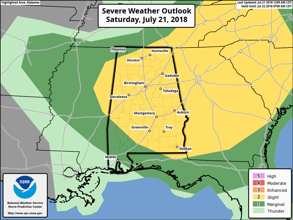
SPC continues a Slight Risk of severe storms for nearly all of North and Central Alabama throughout the day and tonight. Main threat will be from damaging winds, but an isolated tornado or two, along with hail up to quarter size, will be possible.
We’ll continue to have updates throughout the day. Keep checking back often. Any warnings or advisories that are issued by the NWS will automatically post to the blog within seconds of being issued.



