


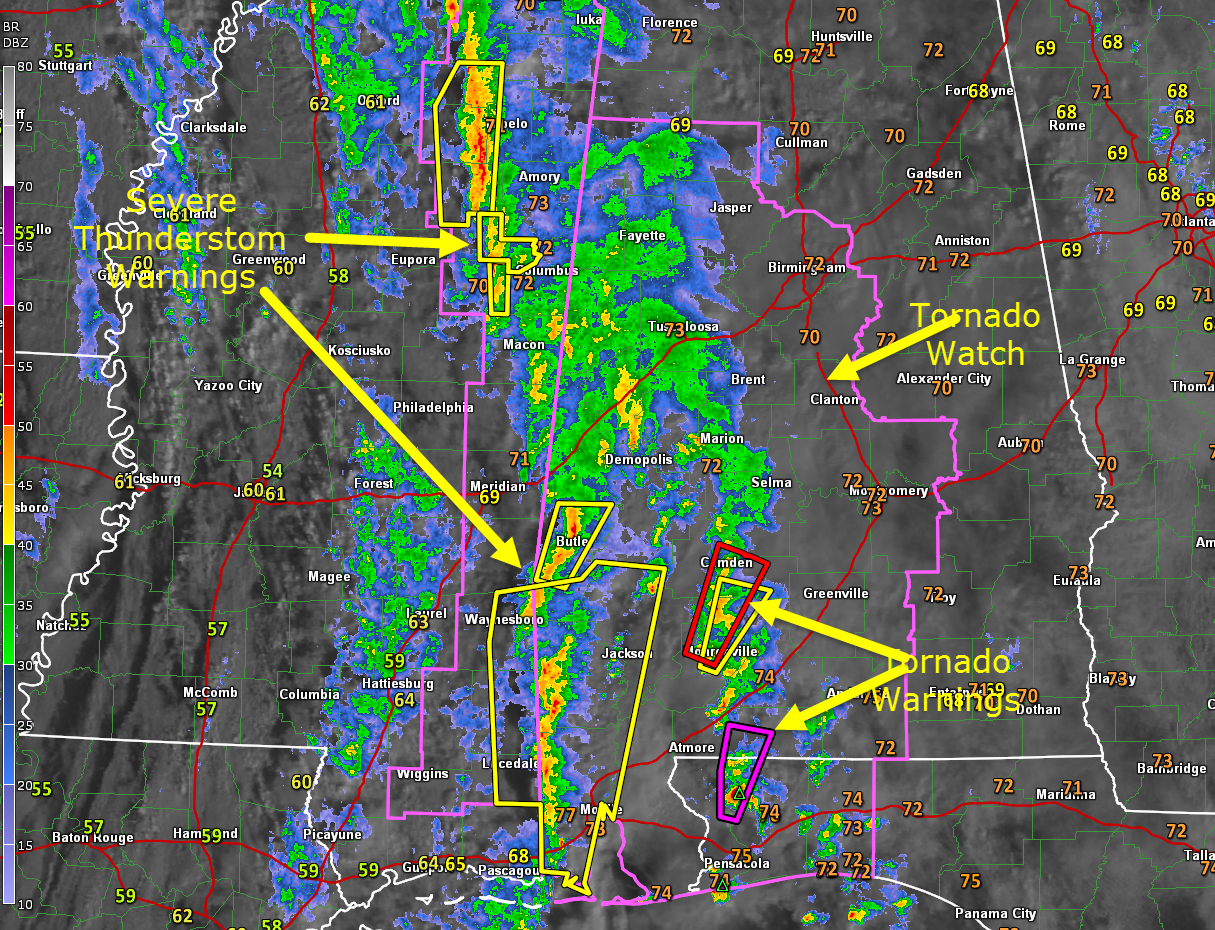
Three tornado warnings right now across southwest Alabama and Northwest Florida. There is a radar confirmed tornado with a debris signature northeast of Molino in Santa Rosa County north of Pensacola. This storm will move into Escambia County AL near Brewton. The NWS in Mobile has a particularly dangerous situation tag in this warning.
There are several other severe thunderstorm warnings in effect from Choctaw County down to Mobile County.
In Northeast Mississippi, there are severe thunderstorm warnings from Starkville to New Albany. There was a wind damage report from Grenada with these storms around 6:22. This activity will move into Lamar and Marion Counties around 9 a.m. but severe weather doesn’t look likely at this time.
The leading edge of the area of rain and storms extends from Carbon Hill to Berry to Tuscaloosa to Uniontown. Most of the precipitation is just moderate to heavy rain, but there are thunderstorms over Greene and Marengo Counties from Eutaw to Forkland to near Demopolis.
The best chance of severe weather is South Alabama and Northwest Florida right now. Further away from the coast, marginal instability and strong wind shear still mean severe weather is possible, especially as a strong upper level wind max approaches from the southwest. A tornado watch remains in effect until noon for the western half of Central Alabama. We will continue to monitor the rotating storms to see if they can produce a tornado or two or trigger damaging winds.
Also, a flash flood watch remains in effect through this afternoon for North and Central Alabama.
Finally, even outside thunderstorms, winds will be strong and gusty today, averaging 15-25 mph and occasionally gusting to 30 mph or higher.



