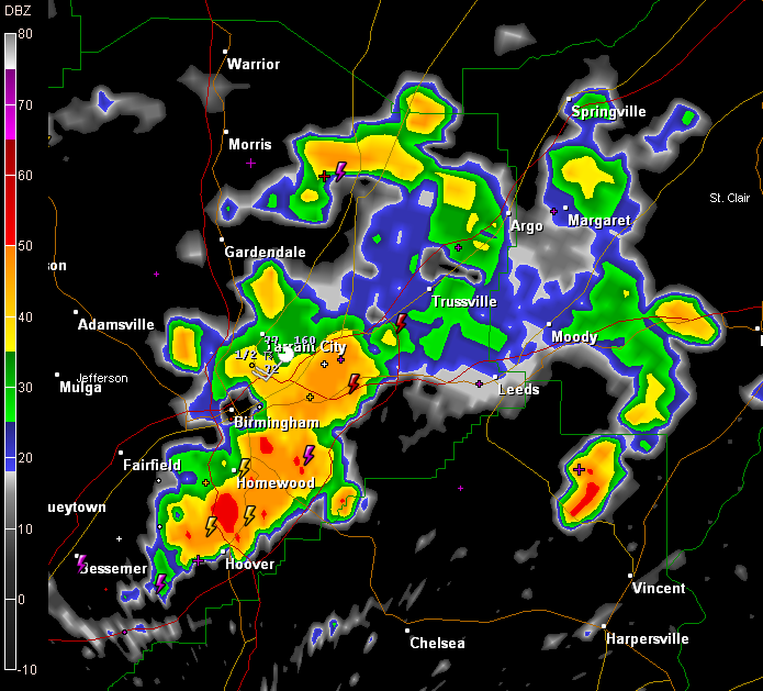
Radar indicates intense storms still across much of the eastern part of Birmingham from Roebuck Plaza through Irondale, Mountain Brook, Cahaba Heights, Vestavia, Homewood and Hoover.
The storms are weakening but are still packing a punch with heavy rain, lightning and gusty winds. They are building southward now.
A strong storm was entering northwestern Jefferson County east of Sumiton.
Other storms are…
…over Winston and entering Cullman Counties
…over East Alabama’s Clay, Cleburne and Randolph Counties south of I-20.
…over Hale and southern Tuscaloosa Counties about to enter Bibb County….particularly intense call about 15 miles southwest of Centreville
…others over Pickens, Greene and Sumter Counties in West Alabama. A severe thunderstorm warning continues for these counties until 315 p.m.
LATE NOTES
…Chuck Biddinger reports 1.92 inches of rain mostly in one hour on the western side of downtown Trussville.
…Judy Freeman reports temperature dropped from 98F to 71F at her location in Center Point.
…50 mph wind gust just reported in Homewood