


The NWS in Birmingham launched a special balloon before noon. Here is the SkewT diagram:
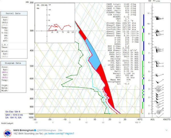
It shows 1,146 j/kg of CAPE, which is solidly unstable. The lifted index reflects this also with a reading of -6.
There is no convective inhibition (CIN).
The 0-1km storm relative helicity is 204 m2/s2, which is marginal for tornadoes.
The storms over eastern Mississippi are now into western Marion County. That Marion County storm looks impressive on radar for sure but no warnings yet.
The storms over Mississippi have become more linear in nature, which may be good news from a tornado standpoint. hail and damaging winds will be a significant threat though.
Tornado watch continues until 6 p.m. for North and North Central Alabama.



