


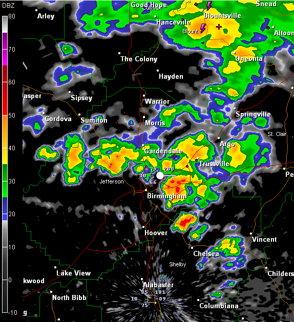
Storms in the Birmingham area are dumping some brief heavy rain in spots along with some lightning and loud thunder as well as gusty winds, but they are not severe.
The heaviest rain right now is along I-20 from the Airport to the intersection with I-459.
A strong storm is also developing just northwest of Chelsea in northeastern Shelby County.
The southward moving outflow from these storms are along will separate unstable air to the south and more stable air to the north and will be the northern boundary for the main severe weather threat today.
A severe thunderstorm watch is in effect for much of West and Central Alabama until 6 p.m. The watch includes Lamar, Fayette, Walker, Jefferson, Shelby, Coosa and counties to the south and west.
Flooding now being reported in Northwest Alabama, where very heavy rain has occurred. It is likely tat 3-5 inches has fallen over much of Colbert and Lauderdale Counties. A late report indicates that a vehicle (unoccupied) was floating down a creek near Lexington…with numerous roads between Lexington and Killen closed due to flash flooding. Roads are being closed in Tuscumbia and roads have been closed in Corinth MS.
We’re going to see lots of heavy rain over Marion, Winston, Lamar and Fayette Counties into Walker County over the next couple of hours as well.



