


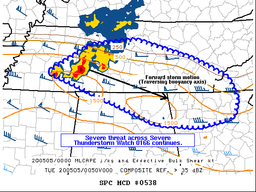
From the Storm Prediction Center:
The severe weather threat for Severe Thunderstorm Watch 166 continues.
SUMMARY…
Severe threat continues across WW 0166. Large hail and damaging gusts are the primary threat.
DISCUSSION…
An organized MCS is ongoing across southern parts of Middle TN, with a history of large hail up to golfball size and occasional damaging wind gusts. Mid-level flow paralleling MCS motion remains strong (60+ knots at 500 mb), with an axis of 1000-1500 J/kg MLCAPE residing downstream of the MCS. As such, the severe threat is expected to continue for at least a few more hours across the Severe Thunderstorm Watch area, before gradually diminishing during the overnight hours, as supported by the latest high-resolution model guidance.



