


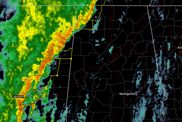
Severe thunderstorms continue to push slowly eastward through the northwestern parts of North/Central Alabama while the rest of the line of strong to severe storms continue a slower progression eastward through parts of Mississippi. At this point, two severe thunderstorm warnings are in effect for portions of Colbert, Franklin, Lauderdale, and Lawrence counties until 9:15 am. Severe thunderstorm warnings stretch along and ahead of the line from West Point to Monticello in Mississippi.
Over the next several hours out ahead of the line, we should see instability continue to rise which will add fuel to the fire for these stronger to severe storms as they move eastward through the area. We are also still seeing high STP values over the western half of North/Central Alabama, topping out over 5.5 in the west and west-central parts of the area.
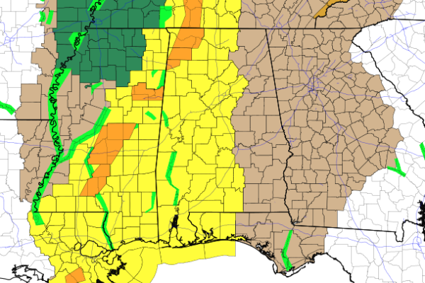
Tornado watches continue for portions of North/Central Alabama, with the northwestern counties set to expire at 1:00 pm, while the rest of the counties set to expire at 4:00 pm.
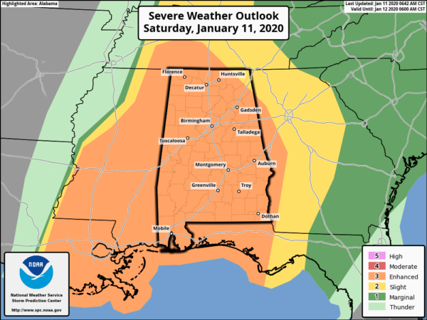
SPC continues nearly all of North/Central Alabama in an Enhanced Risk (level 3 of 5) for the rest of the day, while a small corner of the northeastern part of the area is in a Slight Risk (level 2 of 5). Tornadoes and damaging winds in excess of 70 MPH are possible with these storms. If any supercells can form out ahead of the main line, then we could have the potential for a strong tornado or two (EF2 or greater).
Continue to be prepared and stay weather aware. Have those multiple ways to receive warnings and keep those smartphones charged. We’ll continue to have updates throughout the day.



