


An all new edition of the ABC 33/40 Weather Xtreme video is available in the player on the right sidebar of the blog. You can subscribe to the Weather Xtreme video on iTunes by clicking here.
WET IS THE WORD: You will have a hard time finding much sunshine around here for the next 7 days as a challenging and unsettled weather pattern sets up across the Deep South, complete with a mild spell followed by sharply colder temperatures by the weekend.
TODAY: We have light rain on radar over much of North/Central Alabama to start the day. Below is a radar peek just before 6:00…
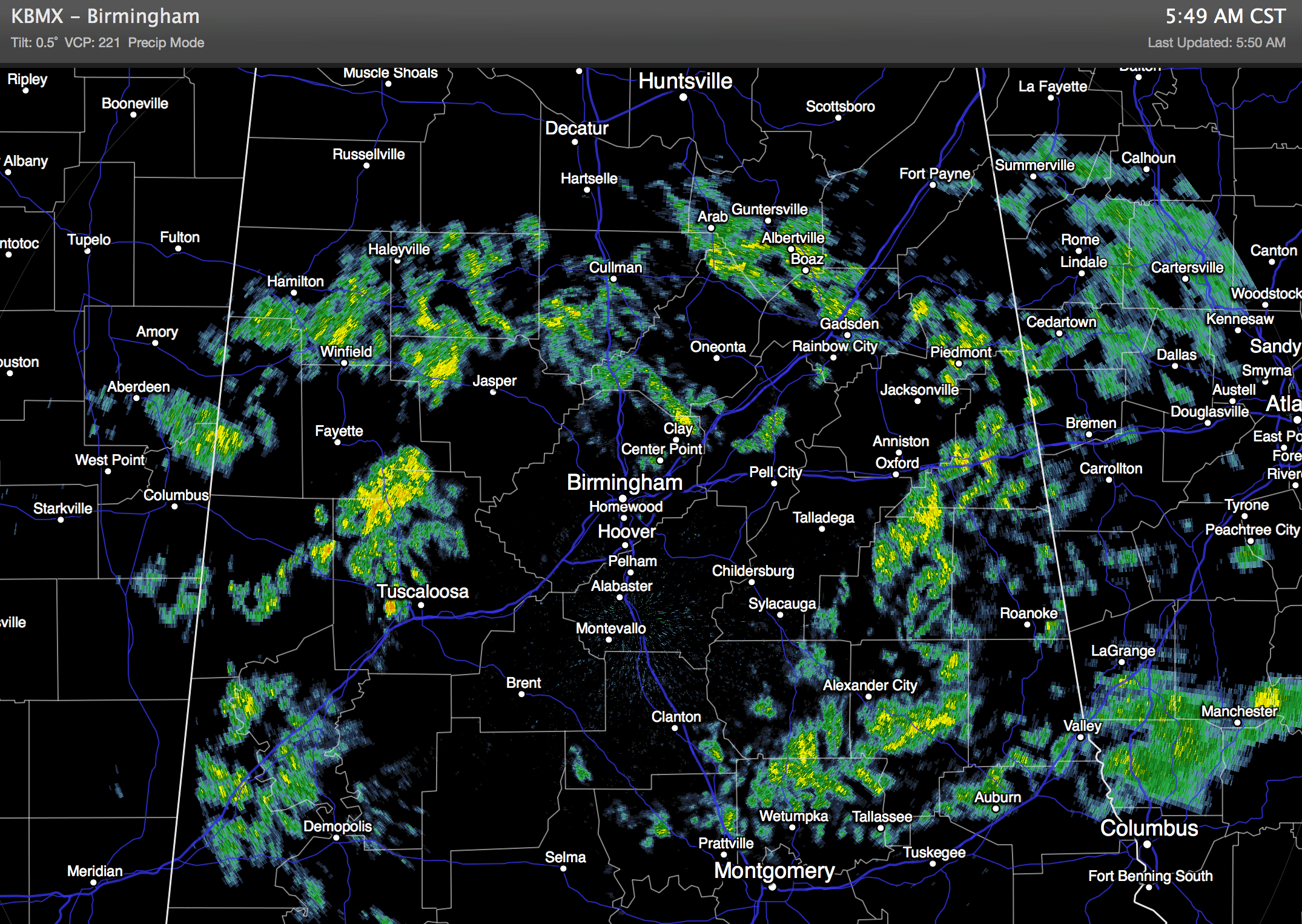
Expect a few periods of light rain today with a cloudy sky with temperatures holding in the 50s.
WARMER TOMORROW: The weather turns warmer as temperatures rise into the upper 60s by afternoon, about 5 to 8 degrees above average for early December. The sky will stay generally cloudy, but a decent part of the day will be dry with only isolated showers.
INTO THE 70s WEDNESDAY/THURSDAY: The NAM is printing a high of 76 degrees for Birmingham on Wednesday afternoon… that is within two degrees of the record high of 78 (set in 1998) for December 4. Not sure it gets that warm, but low to mid 70s are likely. The sky will be mostly cloudy, although the sun might peek out a bit. And, we will need to mention a risk of scattered showers. Not much change on Thursday; mostly cloudy and very mild with a chance of showers and a high in the low to mid 70s.
HOWEVER… Don’t get used to the mild temperatures. Brutally cold air will invade the northern U.S. in coming days; I expect to see some spots over Montana and North Dakota reaching -30 degrees (F) by Wednesday and Thursday morning. This cold air will move south, and should begin to seep into Alabama late this week.
The cold air will be very shallow as it moves into our state, and with a continued southwest flow aloft, that will set up some icing problems for parts of the Mid-South.
FORECAST UNCERTAINTY: Let me say up front that conventional tools we use, like MOS (model output statistics) products will not be very useful late this week and over the weekend; there is simply not enough resolution to handle the very shallow cold air, and the model numbers, most likely, will be way too warm. And, our skill at dealing with ice events days in advance is very low.
ALABAMA ON FRIDAY: There should be a huge thermal gradient across the state. Places like Muscle Shoals, Florence, Russellville, and Hamilton won’t get out of the 40s; the high in Birmingham should be in the low 50s, and Montgomery could see a high in the 60s. A wave will bring rain to the state much of the day, and it will be a cold rain for Northwest Alabama.
To the west, an icy mess is possible with freezing rain and ice accumulations possible for places like Memphis, Little Rock, and Dallas. Be aware of this if you are traveling west.
OUR WEEKEND: Cold and wet is the story. Shallow cold air stays in place with a disturbed southwest flow aloft putting moisture up and over the cold air. Some rain is likely Saturday, and we won’t get out of the 40s around here (Birmingham, Tuscaloosa, Anniston, Gadsden). Our friends up in Northwest Alabama (Hamilton to Muscle Shoals) probably won’t get out of the 30s with a chance of rain. However, the greatest risk of freezing rain will remain west of the state, where ice accumulations are possible deep into Texas, maybe even as far south as San Antonio.
We will keep the chance of rain going on Sunday, and we stay cold with temperatures having a very hard time getting out of the 40s during the day.
SUNDAY NIGHT/MONDAY MORNING: This is a period to watch closely, and I do believe there is a real chance of some freezing rain over at least Northwest Alabama with surface temperatures expected to be in the 30-34 degree range. The rest of the state will just have a cold rain. But, remember this is 6 days away and there is little skill in dealing with this kind of weather event so far in advance.
BOTTOM LINE: The chance of freezing rain and ice accumulation is high later this week for parts of Texas, Oklahoma, Arkansas, West Tennessee, and maybe even parts of West Mississippi. If we have freezing rain issues in Alabama, the main threat will come over the northwest counties Sunday night into Monday morning. Stay tuned this week for updates and possible forecast changes.
Take some time to watch the Weather Xtreme video for the maps, graphics, and details.
WEATHER BRAINS: Don’t forget you can listen to our weekly 90 minute netcast anytime on the web, or on iTunes. This is the show all about weather featuring many familiar voices, including our meteorologists here at ABC 33/40. Roger Edwards of the Storm Prediction Center will be our guest this week; the show begins at 8:30 CT tonight, and you watch watch it live on “James Spann 24/7” on cable systems around the state, or on the web here.
CONNECT: You can find me on all of the major social networks…
Facebook
Twitter
Google Plus
Instagram
Busy day ahead… I have weather programs today at Elvin Hill Elementary School in Columbiana, and Gwin Elementary in Hoover. Look for the next Weather Xtreme video here by 4:00 or so this afternoon. Enjoy the day!



