


UPDATE JUST AFTER MIDNIGHT
As expected, temperatures are starting to rise over the western half of North and Central Alabama tonight. The mercury jumped 2 degrees in the past hour at Haleyville and Cullman to freezing. Readings are at or just below freezing at some spots in East Alabama, but those temperatures should start to rise in the pre-dawn hours as well. Still, be alert for any precipitation falling into surface air that is near freezing, especially over East and Northeast Alabama early on Monday morning. Remember, bridges and overpasses can freeze before other road surfaces, even with temperatures just above freezing.
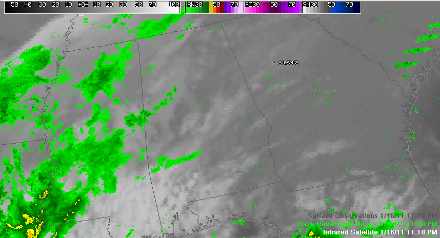
It’s a close call on freezing precipitation over parts of East Central Alabama and the Tennessee Valley late this evening as showers move into western sections of the state.
We should be okay in most locations. It is not out of the question that some of the colder spots of eastern, northeastern and northern Alabama could see some light freezing rain before temperatures rise toward morning.
Here are current official reporting station numbers for the northern half of Alabama at 11 p.m.
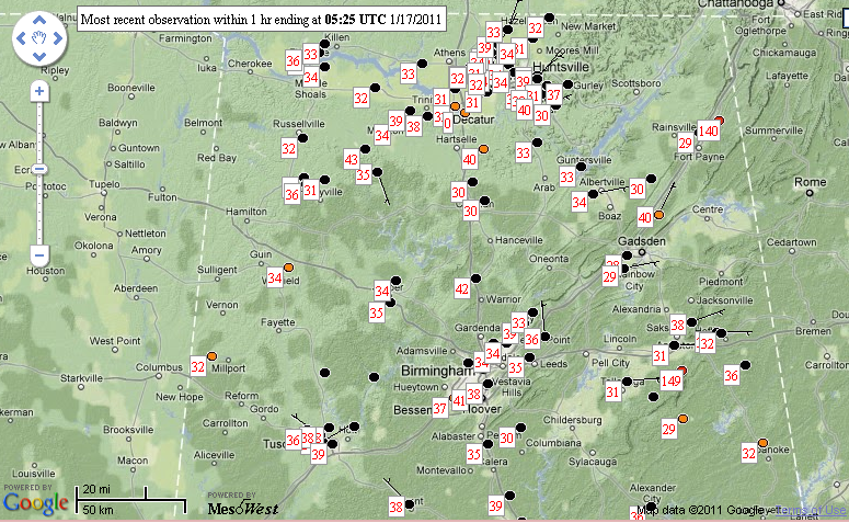
Of greatest concern will be two areas:
1. From Marion County over to Cullman County down through Blount into extreme Northeast Jefferson, northwestern St. Clair and Etowah Counties.
2. From eastern Shelby County around Columbiana through Talladega into the Anniston and Heflin areas up into Cherokee County.
We still think temperatures will rise slowly during the remainder of the night ending the threat, but it is worth monitoring before you get started in the morning.
You know the drill. Be especially alert on bridges and overpasses in colder areas that are in the 30-34F. Those surfaces will freeze first. Slow down and leave plenty of time and room for reaction.



