A Cloudy And Cool December Day For Your Wednesday
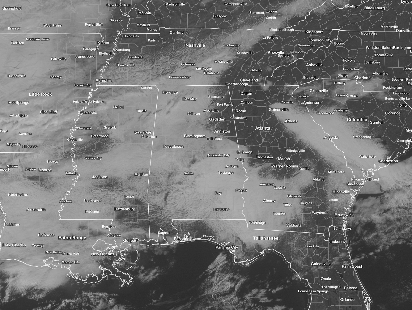
At the midday hour, clouds pretty much cover all of the state except for some clear skies in the northeastern parts of the area. Gadsden, Centre, Anniston, and Jacksonville are a few locations who are lucky enough to see some sun at this point. Skies will continue to be mostly cloudy to cloudy for the remainder of the day across Central Alabama, with afternoon highs in the 50s across the area. A few spots in the extreme southeastern parts of the area may reach the low 60s. Birmingham’s high is expected to be 55 degrees, which is 3 degrees lower than the average high for today.
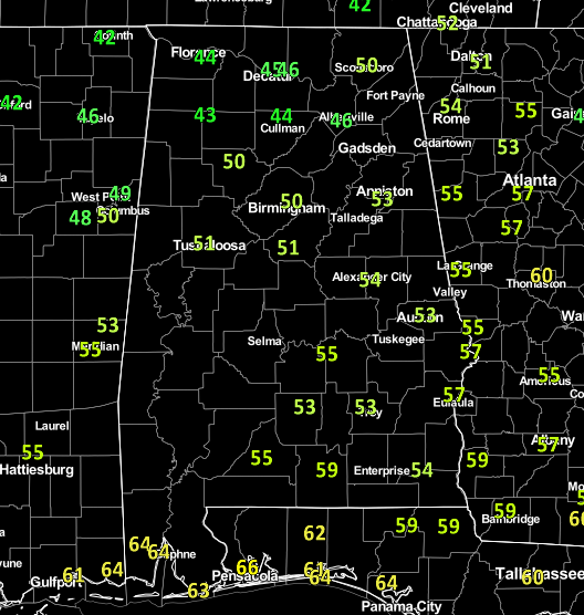
Temperatures at the noon hour across the state are currently in the 40s and 50s. The warm spot in the state at this point is Mobile at 64 degrees, while the cold spot is Haleyville at 43 degrees.
Birmingham’s Climatology And Records
The normal high for December 7th is 58, while the normal low is 37. The record high for today was set back in 1951 at 80. The record low was set back in 1937 at 12.
Arctic Blast Invades The Area On Thursday
A strong cold front will push across the area during the early morning hours, but it looks like the forecast models have really backed off of any rain falling along and ahead of the front. Both the HRRR and European models are showing no rainfall at all, with the GFS showing that a few sprinkles could fall over the extreme northern parts of the area. But the big news out of tomorrow will be the gusty winds with the much cooler temperatures during the day. Afternoon highs will only get to the mid to upper 40s across the area north of US-80 and I-85, with low 50s along and south of that. Clouds will start to decrease during the afternoon hours, and winds will be out of the north in the 15-25 MPH range.
National Extremes
Stuart, Florida, recorded the warmest high temperature for Tuesday, at 90 degrees. The coldest low temperature for last night into the early morning hours today was recorded in West Yellowstone, Montana, at -27 degrees. Brrr, that’s cold!!!
On This Day In 1989
A storm moving out of the Central Rocky Mountain Region spread snow across Kansas and Oklahoma into Arkansas and Tennessee. Snowfall totals ranged up to 7.5 inches at Winfield KS. Freezing rain on trees and power lines cut off electricity to 24,000 homes in northeastern Arkansas, and 40,000 homes in the Nashville TN area were without electricity for several hours.
Follow The Blog On Twitter
Be sure to follow the Alabama Wx Weather Blog on Twitter. Just click here to start following our feed.
WeatherBrains
This is the weekly netcast that’s all about weather featuring many familiar voices, including our meteorologists at ABC 33/40. This week, the panel talked about water, something that we have learned to appreciate even more in the past few weeks. You can listen anytime on the web, or on iTunes. You can find it here.
Forecaster: Scott Martin (Twitter: @scottmartinwx)