


It was a nice day across much of Central Alabama on this February Saturday.
A cold front moved across the area during the day, but will little fanfare. Temperatures warmed nicely in near full sunshine. Birmingham hit 65F, Tuscaloosa and Anniston reached 68F, Auburn 70F, and Montgomery 73F.
It was a different story across North Alabama, where the high in Muscle Shoals was just 51F and Huntsville only managed 56F.
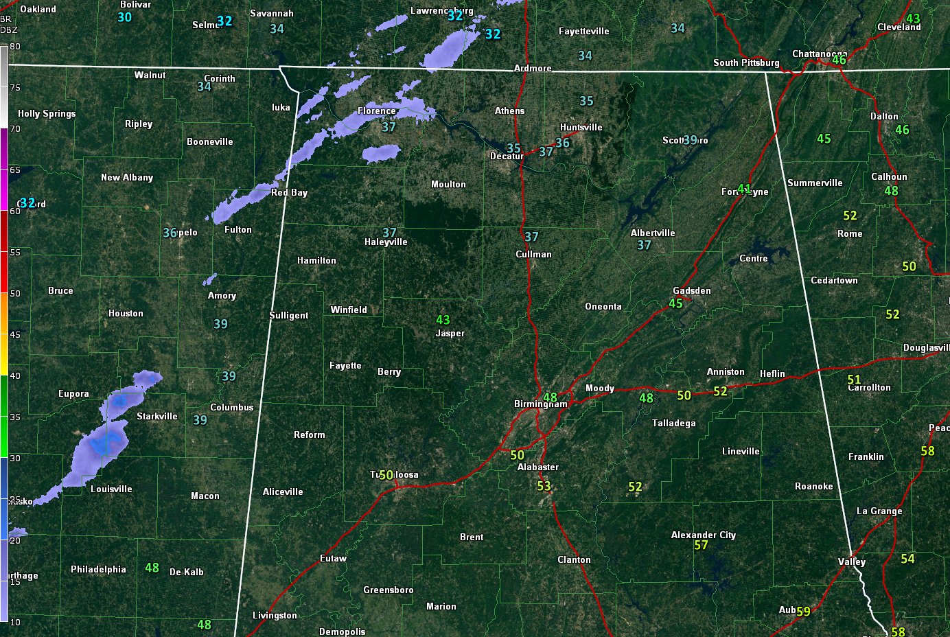
A band of clouds and light precipitation is moving across northern Mississippi., Middle Tennessee, and Northwest Alabama. Temperatures now are down to 35F at Decatur, 37F at Huntsville, Haleyville, and Muscle Shoals.
It is 32F at Oxford MS and 31F at Memphis.
A fee snow flurries have been reported across northern Mississi[pi and Middle Tennessee, and it is not out of the realm of possibilities tonight across North and Central Alabama. But the precipitation will be light and insignificant.
Overnight lows tonight will be in the lower and middle 20s across North Alabama, with upper 20 to lower 30s across the Central part of the state.
Tomorrow will be sunny but cold. Highs will not get out of the 40s except over South Central Alabama.
Things will be quiet til Thursday when Alabama will deal with a severe weather threat. There are still lots of details to be worked out. For now, we wil call for strong to severe storms, with a chance of damaging winds and tornadoes. Stay tuned.



