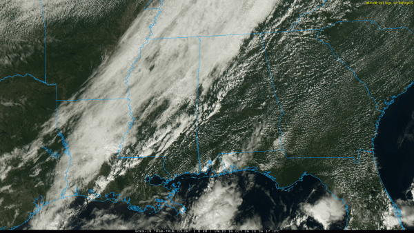
ON THE MAP: A cold front is near I-59 (Tuscaloosa to Birmingham to Gadsden) at mid-afternoon; behind the front temperatures are in the upper 50s and low 60s with a very cool northwest wind. The front will move quickly southward, reaching the Gulf Coast by midnight. Showers will remain few and far between, but the sky will be mostly cloudy tonight in many areas as the cool air rolls into the Deep South.
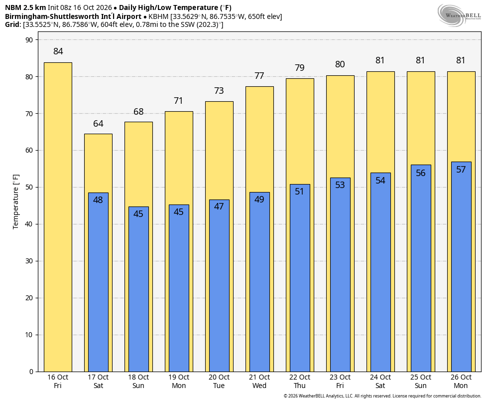
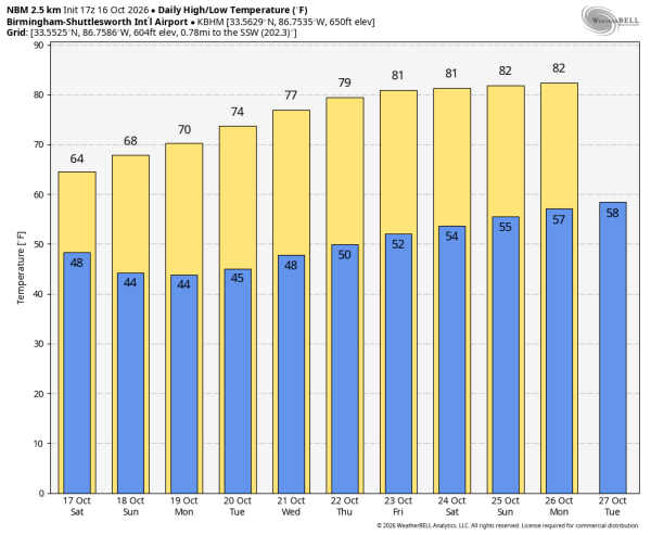
The coolest air so far this season will settle into Alabama for the weekend. Expect highs in the 60s, lows mostly in the 40s, and a sun filled sky both days.
NEXT WEEK: Dry weather continues with a slow warming trend. Afternoon highs will be close 80 degrees by the end of the week.. See the video briefing for maps, graphics, and more details.
TROPICS: The Atlantic basin is quiet and tropical storm formation is not expected for at least the next seven days.
FOOTBALL WEATHER: You might consider a jacket for tonight’s high school games… temperatures will fall through the 50s during the games with a brisk north wind.
Auburn travels to Athens to take on Georgia tomorrow (2:30p CT kickoff). It will be a perfect day for the game; a sunny sky with upper 60s at kickoff, falling into the 60s by the fourth quarter.
Alabama will be on the road as well… they play Tennessee in Knoxville (2:30p CT kickoff). A sun filled sky, temperatures in the upper 50s at kickoff, low 50s by the fourth quarter.
Tomorrow is homecoming for Alabama A&M; they host Grambling State (2:00p CT kickoff). The sky will be sunny with temperatures in the mid 60s at kickoff, falling into the 50s by the second half.
The weather will be clear and very pleasant for all of the other games across Alabama and the Deep South tomorrow.
ON THIS DATE IN 1999: Hurricane Irene moved across the Florida Keys producing heavy rainfall, strong winds, and high waves. A gust 102 mph was reported in Big Pine Key.
Look for my next video briefing here by 6:00 a.m. Monday… enjoy the weekend!