


“It was a dark and stormy night…”
I just always line using that line on nights like this. It was the opening line to every novel that Snoopy ever started on his little typewriter on top of his dog house.
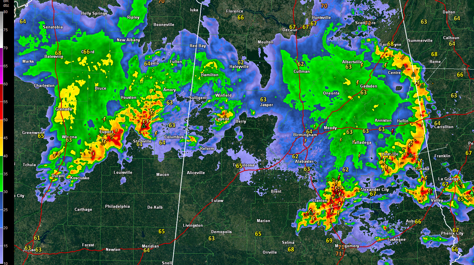
The bad news is that it isn’t over. The good news is that the upstream storms are slowly weakening, like the MCS that is now moving through the eastern part of the state.
So far so good, with just a few reports of trees down in Lamar County, some golfball and half-dollar-sized hail in Winston County and plenty of lightning, 40 mph wind gusts and heavy rain to go around.
The first arc of storms, associated with a mesoscale convective systemwide em, extends from southern DeKalb County through Cherokee County, then hugs the Alabama/Georgia border down to the east of Heflin. It then arcs from to between Lineville and Roanoke and then terminates in a big complex of storms over Chilton County.
The strongest storms are over Chilton County at this time. An areal flood advisory has been issued for parts of that area. They are moving into Elmore and Coosa Counties.
Other storms are over Fayette and northern Pickens Counties at this hour, but they aren’t strong.
The complex of storms over eastern Mississippi is holding together, however, and will reach western Alabama within the next 90 minutes, around 12:30 a.m. Areas from Marion and Lamar Counties down into Pickens County will be the target of this area of storms. They aren’t severe, having weakened a bit in the past 60 minutes. But they are capable fo wind gusts to 40 mph, dangerous lightning and heavy rain.
They should continue to weaken as they push east northeast into Northwest Alabama over the next few hours.



